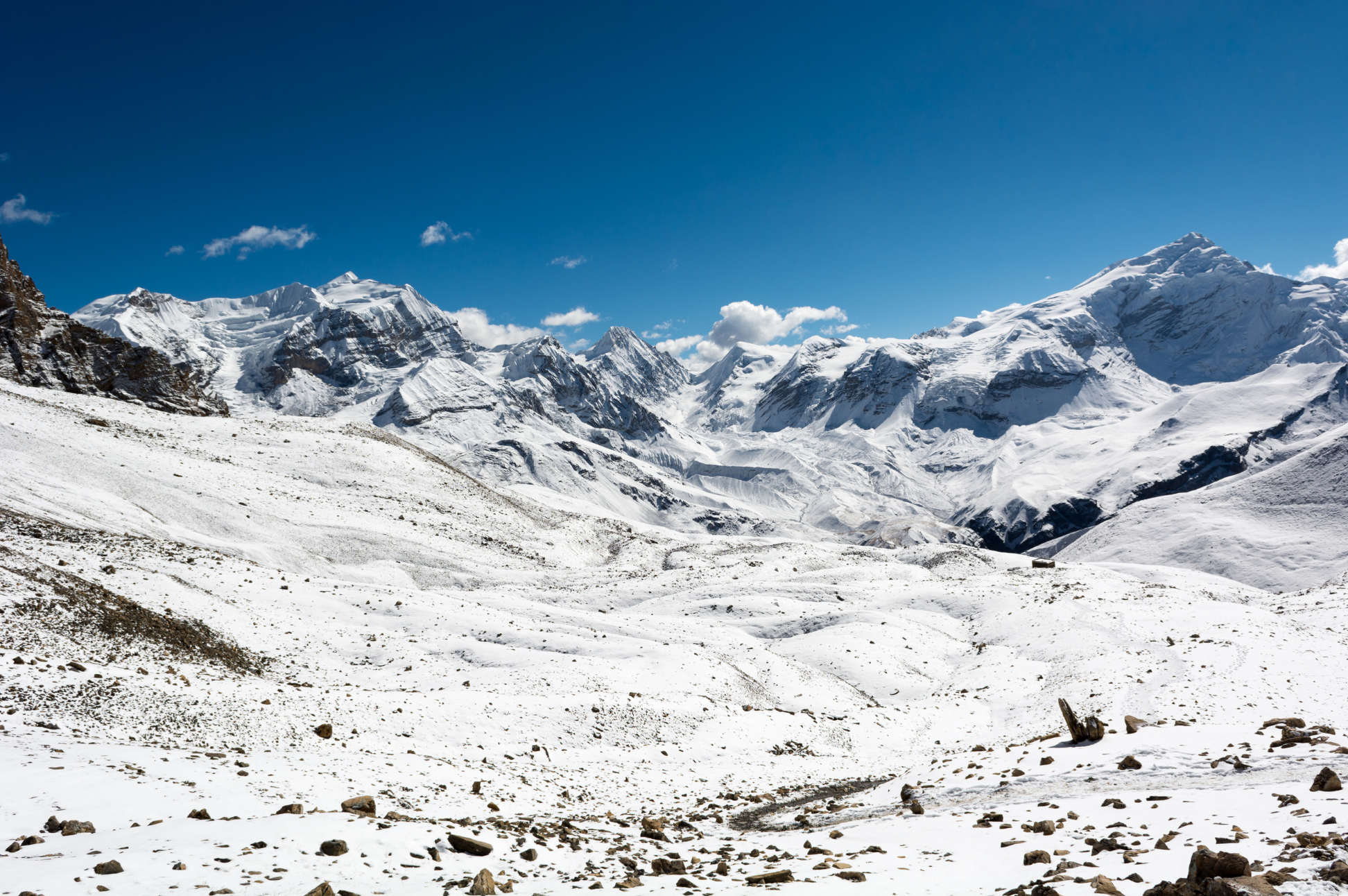
Annapurna Circuit
0 wishlisted0 done
Sign in to save this trek to your list.
Is This Trek for You?
Choose the Annapurna Circuit if you want a long, varied journey and are comfortable with changing terrain, road sections, and a very high pass crossing. It rewards experienced walkers with strong acclimatization habits; it is a poor fit for anyone who dislikes long days, altitude above 5,000m, or flexible plans.
Overview
The Annapurna Circuit is a classic long-distance trek. The itinerary shown has 11 days on foot from Besisahar to Jomsom, circling much of the Annapurna massif through landscapes that change so dramatically they feel like different countries — from steaming subtropical rice paddies and dense rhododendron forests to barren high-altitude desert and the Kali Gandaki valley.
The crown jewel is Thorong La Pass at 5,416m (17,769 ft). Standing here, with the Annapurna and Dhaulagiri ranges on the horizon, is a moment you’ll carry forever. But the Circuit isn’t just about the pass. You’ll walk through traditional Gurung and Thakali villages, visit Buddhist monasteries, soak in natural hot springs at Tatopani, and experience the stark beauty of the Kali Gandaki valley.
What sets the Circuit apart from other Himalayan treks is the sheer diversity. The southern side is lush and green, fed by monsoon rains. Cross to the northern side and you’re in a rain-shadow desert with wind-eroded cliffs and Tibetan Buddhist culture. You’ll taste it in the food too — dal bhat in the lowlands gives way to Tibetan bread and butter tea as you climb. Every day brings a completely new landscape.
Route & Key Stops
Besisahar
The trek begins in Besisahar (760m), the gateway to the Annapurna Circuit. Accessible from Kathmandu by bus (6-7 hours) or from Pokhara, Besisahar sits at the edge of the Annapurna Conservation Area. The trail follows the Marsyangdi River through terraced rice paddies and subtropical farmland.
Chame
Chame (2,670m) is the district headquarters of Manang and marks the transition from subtropical to alpine landscape. The town sits in a deep valley with dramatic views of Annapurna II and Lamjung Himal. An ancient Buddhist monastery and natural hot springs make this a memorable stop.
Manang: The Acclimatization Hub
Manang (3,540m) is the largest village on the circuit and the critical acclimatization stop. Surrounded by towering peaks — Annapurna II, III, IV, Tilicho Peak, and the Chulu ranges — Manang offers incredible day hikes to Ice Lake (4,600m), Gangapurna Lake, and the Himalayan Rescue Association clinic. The village has a distinctly Tibetan Buddhist character with ancient monasteries and prayer wheels.
Thorong La Pass: The High Point
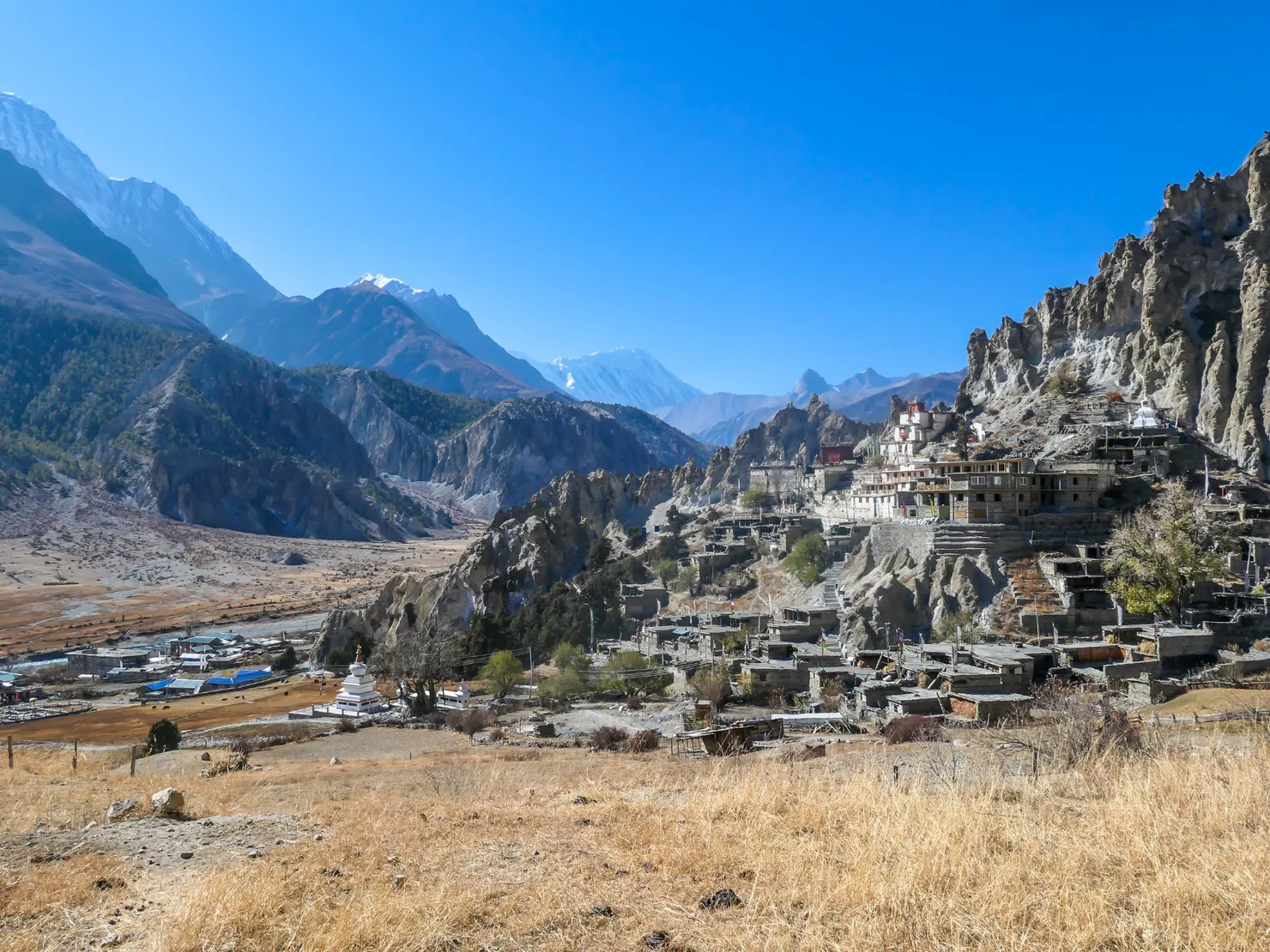
Thorong La (5,416m) is the highest point on the standard Circuit. The crossing usually starts early from Thorong Phedi, climbing through snow and rock before reaching the pass marked by prayer flags. The descent to Muktinath is long and steep.
Muktinath: Sacred Temple Town
Muktinath (3,800m) is a sacred pilgrimage site for both Hindus and Buddhists. The temple, with its eternal flame fed by natural gas, sits in a stark, beautiful landscape at the edge of the Kali Gandaki gorge. After the intensity of the pass crossing, Muktinath feels like a place of profound peace.
Kagbeni & Jomsom
Kagbeni (2,800m) is a medieval walled town and the gateway to Upper Mustang. From here, the trail follows the Kali Gandaki gorge, flanked by Dhaulagiri (8,167m) and Annapurna I (8,091m). The landscape is dramatically different from the southern side: arid, wind-swept, and otherworldly.
Pokhara
Pokhara (820m) is the lakeside city where most trekkers end their journey. After days in the mountains, the lakeside promenade, rooftop restaurants, and cold beers feel like heaven. The dramatic flight from Jomsom through the Kali Gandaki gorge is one of Nepal’s most spectacular.
Itinerary
1Besisahar to Bhulbhule
Begin in Besisahar (760m), the gateway to the Annapurna Circuit. The trail follows the Marsyangdi River through rice paddies and subtropical farmland. Pass through Khudi and reach Bhulbhule, a small village with views of Manaslu.
2Bhulbhule to Chamje
Continue along the Marsyangdi valley through waterfalls and suspension bridges. The trail passes through Jagat and Tal, a wide valley floor that was once a lake. Dense subtropical forest lines the river gorge.
3Chamje to Chame
Enter the Manang district. The landscape shifts from subtropical to alpine. Pass through Dharapani (where the Manaslu Circuit joins) and climb through pine forest to Chame, the district headquarters with views of Annapurna II and Lamjung Himal.
4Chame to Upper Pisang
Walk through deep forest with dramatic views of Paungda Danda rock face. The trail climbs steadily through the narrow Marsyangdi valley. Upper Pisang sits on a ridge with stunning views of Annapurna II, III, IV, and Gangapurna.
5Upper Pisang to Manang
Take the high route through Ghyaru and Ngawal for the best mountain panoramas of the trek — Annapurna II, III, IV, Tilicho Peak, and Chulu ranges fill the horizon. Descend to Manang, the largest village on the circuit.
6Acclimatization in Manang
Essential rest day at 3,540m. Hike to Ice Lake (4,600m) or Gangapurna Lake for acclimatization. Visit the Himalayan Rescue Association clinic for an altitude sickness talk. Explore Manang’s ancient monastery and the local Tibetan Buddhist community.
7Manang to Yak Kharka
Leave Manang and climb gradually through juniper and scrub forest. The valley narrows and the vegetation thins. Yak Kharka is a seasonal herding settlement with sparse vegetation and stark mountain scenery.
8Yak Kharka to Thorong Phedi
Short but critical day. Descend to the Marsyangdi river crossing and climb to Thorong Phedi (4,525m), the base of the Thorong La Pass. Rest well — tomorrow is the biggest day of the trek.
9Thorong La Pass Crossing
The legendary day. Start at 4-5am for the steep climb to Thorong La (5,416m) — the highest point of the trek. Stunning panoramic views of Annapurna, Dhaulagiri, and Manaslu. Long descent to Muktinath (3,800m), a sacred pilgrimage site for both Hindus and Buddhists.
10Muktinath to Kagbeni
Visit the sacred Muktinath Temple before descending through the arid Kali Gandaki gorge. The landscape is dramatically different — rain-shadow desert with wind-eroded cliffs. Kagbeni is a medieval walled town and the gateway to Upper Mustang.
11Kagbeni to Jomsom
Walk along the Kali Gandaki riverbed — a spectacular, deeply incised gorge flanked by Dhaulagiri (8,167m) and Annapurna I (8,091m). The dry, windy trail passes through Muktinath and arrives in Jomsom, the district hub.
Alternative Itinerary
The itinerary shown has 11 days on foot. Longer versions add lower-valley walking, more time in Manang, or the Tilicho Lake detour (4,919m); road transfers to Besisahar and onward from Jomsom are separate.
Route Map
Elevation Profile
Logistics & Support
Getting There and Back
Getting to the trailhead: The itinerary starts walking in Besisahar. Reach it from Kathmandu or Pokhara by bus or jeep; allow most of a day for the road journey and confirm the current roadhead with your operator, as some groups drive farther up-valley and shorten the walk.
Returning from the trail: This itinerary ends on foot in Jomsom. Continue to Pokhara by flight or road; flights are weather-dependent, so leave a buffer before onward connections.
Accommodation
Teahouses line the entire route. They’re simple but cozy — locally run, with warm dining rooms and basic twin bedrooms. Hot showers, Wi-Fi, and device charging are available for small extra fees ($2-5 each). The higher you go, the more basic the facilities become. Bring a good sleeping bag — rooms have no heating above 3,000m.
Guides & Porters
Nepal Tourism Board lists the Annapurna Circuit among routes requiring a licensed guide and agency-issued TIMS. Arrange these through a registered trekking agency and confirm current checkpoint procedures. A guide can help with navigation, lodge logistics, and decisions around Thorong La weather and altitude. Porters and their load limits vary by agency.
Permits
Two permits cover the Circuit (your trekking agency can arrange both):
- Annapurna Conservation Area entry permit — NPR 3,000 for foreign visitors and NPR 1,000 for SAARC visitors under Nepal Tourism Board’s current fee table. Check the current place of issue and accepted payment methods before departure.
- Agency-issued TIMS card — NPR 2,000 for non-SAARC trekkers and NPR 1,000 for SAARC trekkers under current NTB guidance. The Circuit is listed among routes requiring a guide and agency-issued TIMS.
Carry your passport, two passport-sized photos, your insurance policy number, and cash in Nepali rupees (permit counters don’t accept cards).
High-altitude trekking and rescue insurance is strongly recommended. Check that your policy explicitly covers the elevations on your itinerary and emergency evacuation. Confirm exclusions and any documentation requirements with your insurer:
- Emergency helicopter evacuation and rescue up to 6,000m (20,000 ft)
- Hospitalization and treatment for Acute Mountain Sickness (AMS), HAPE, and HACE
- Trip cancellation and flight-delay coverage
Permit counters do not universally require proof of insurance; carry your policy and emergency contact details for your own safety.
Budget
| Item | Cost |
|---|---|
| Permits (ACAP + TIMS) | ~$38-40 |
| Guide | $25-40/day |
| Teahouse room | $3-8/night |
| Meals | $4-7/meal |
| Jomsom-Pokhara flight | $100-120 |
| Daily budget | $30-60/day |
Weather & Seasons
The best seasons are Spring (March-April) and Autumn (September-November).
| Season | Conditions |
|---|---|
| Spring (Mar-Apr) | Warming temperatures, rhododendrons in bloom, some haze |
| Autumn (Sep-Nov) | Stable, dry weather with crystal-clear mountain views — peak season |
| Winter (Dec-Feb) | Very cold, heavy snow on Thorong La, trails often blocked |
| Monsoon (Jun-Aug) | Heavy rain, landslides, dangerous trail conditions |
Autumn offers the clearest skies and most reliable weather for the pass crossing. Spring is warmer but hazier. Winter and monsoon treks are not recommended — Thorong La becomes treacherous with snow and ice.
Tips
- Acclimatize properly. Spend at least 2 full days in Manang before crossing the pass.
- Start early for the Thorong La crossing — weather deteriorates in the afternoon.
- Carry cash. ATMs are rare beyond Besisahar.
- Pack light. Tea houses provide bedding and meals, so you don’t need camping gear.
- Respect the culture. Remove shoes before entering monasteries, walk clockwise around chortens and mani walls.
- Budget for extra days. Weather delays are common, especially at Thorong La.
- Consider the Tilicho Lake detour. It adds roughly two days and brings a high-altitude side trip into the itinerary; allow extra time for weather and trail conditions.
Frequently Asked Questions
Planning
When is the best time to do the Annapurna Circuit?
The best seasons are Spring (March-April) and Autumn (September-November). Autumn offers the clearest skies and most reliable weather for the Thorong La crossing, while spring is warmer with blooming rhododendrons but hazier. Winter (December-February) is very cold and Thorong La is often blocked by snow, and monsoon (June-August) brings heavy rain, landslides, and dangerous trail conditions.
How long does the Annapurna Circuit trek take?
The itinerary shown has 11 days on foot from Besisahar to Jomsom, including an acclimatization day in Manang. Longer route variants can add lower-valley stages, extra rest or the Tilicho Lake detour. Road transfers are separate.
How much does the Annapurna Circuit trek cost?
Budget $30-60 per day for teahouse trekking. Permits total approximately $38-40 (ACAP + TIMS), guides cost $25-40/day, teahouse rooms are $3-8/night, meals are $4-7 each, and the Jomsom-Pokhara flight costs $100-120 one way. Carry cash — ATMs are rare beyond Besisahar.
Do I need to book teahouses in advance?
Yes, especially during peak season (October-November) when demand is high at popular stops like Chame, Manang, and Jomsom. Booking ahead ensures you have a room after a long walking day. Your guide or trekking agency can handle reservations.
Difficulty & Fitness
How difficult is the Annapurna Circuit trek?
The trek is considered hard due to the Thorong La Pass crossing at 5,416m, long walking days of 3-10 hours, and roughly 160-230 km of trail depending on road transfers and side trips. The pass day involves a sustained climb and a long descent. Good physical fitness and prior hill walking are strongly recommended.
How far do you walk each day on the Annapurna Circuit?
Daily distances vary from 8 km on acclimatization days to 18 km on the pass day and longer valley days. Most days fall between 11-15 km. The total distance depends on your route — around 160-230 km (100-145 miles) for the full circuit. Your porter carries the main bag (up to 10 kg) so you only need a daypack.
Do I need trekking poles for the Annapurna Circuit?
Trekking poles are essential. They save your knees on the 1,600m descent from Thorong La, help with balance on rocky and snow-covered sections of the pass, and ease the steep climbs through the Marsyangdi valley. Many trekkers rate poles as their single most useful piece of gear on the Circuit.
Permits & Budget
What permits do I need for the Annapurna Circuit?
The Annapurna Circuit requires an Annapurna Conservation Area entry permit and, under Nepal Tourism Board guidance, a licensed guide and agency-issued TIMS card. The current NTB fee table lists ACAP at NPR 3,000 for foreign visitors and TIMS at NPR 2,000 for non-SAARC trekkers. Confirm current fees and collection arrangements before departure.
Is travel insurance necessary for the Annapurna Circuit?
Travel insurance is strongly recommended. Check that your policy covers trekking at the elevations on your itinerary, emergency helicopter evacuation, and altitude-related illness. Confirm exclusions and any required documentation directly with your insurer; permit counters do not universally require proof of insurance.
Can I trek the Annapurna Circuit without a guide?
Nepal Tourism Board lists the Annapurna Circuit among routes requiring a licensed guide and agency-issued TIMS. Arrange these through a registered trekking agency and confirm current checkpoint procedures. You can still trek privately with your guide rather than joining a group.
Altitude & Safety
How do I prevent altitude sickness on the Annapurna Circuit?
Acclimatize properly: spend at least two nights in Manang (3,540m) before crossing Thorong La. Use the acclimatization day to hike to Ice Lake (4,600m) or Gangapurna Lake — climb high, sleep low. Follow the golden rule and never sleep at a significantly higher elevation than the night before. If you experience a severe headache, nausea, or confusion, descend immediately.
How high does the Annapurna Circuit go and can I handle the altitude?
The highest point is Thorong La at 5,416m (17,769 ft). Muktinath at about 3,800m is a common overnight stop after the crossing. Most healthy people can manage the altitude with proper acclimatization, but altitude affects everyone differently regardless of fitness. Ask a clinician whether acetazolamide is appropriate for you.
Is Thorong La pass dangerous?
The pass is weather-dependent and a major risk factor on the Circuit. Trekkers commonly start early, but timing should follow local forecasts and your guide's advice. Check current snow and trail conditions before committing; heavy snow can make the crossing unsafe or temporarily impassable. Be prepared to wait or turn back.
Logistics
What is the accommodation like on the Annapurna Circuit?
Teahouses line the entire route from Besisahar to Jomsom. They are simple but cozy, family-run lodges with warm dining rooms and basic twin bedrooms. Hot showers, Wi-Fi, and device charging are available for small extra fees ($2-5 each). Facilities become progressively more basic above 3,000m, and rooms have no heating — bring a good sleeping bag rated to -15°C.
What should I pack for the Annapurna Circuit?
Essentials include an insulated down jacket (temperatures at Manang and Thorong La can drop to -20°C), a sleeping bag rated to -15°C, trekking poles (essential for the 1,600m descent from the pass), glacier-strength sunglasses, a headlamp, a waterproof shell jacket and pants (the Kali Gandaki section is windy and dusty), thermal base layers, a warm hat, gloves, a buff, and SPF 50+ sunscreen. Keep your porter bag under 10 kg.
How do I get to and from the Annapurna Circuit?
The trek starts at Besisahar, reachable by bus from Kathmandu (6-7 hours) or Pokhara. Most trekkers finish at Jomsom and take the spectacular morning flight to Pokhara ($100-120, weather permitting), or continue by jeep down the Kali Gandaki gorge via Tatopani and Beni to rejoin the road network. Flights are weather-dependent and can be delayed, so build in a buffer day.