Everest Three Passes
0 wishlisted0 done
Sign in to save this trek to your list.
Is This Trek for You?
Choose Three Passes if you want the Everest region at its most demanding and rewarding, with high crossings, remote valleys, and exceptional mountain views. You need strong fitness, previous high-altitude experience, flexible weather plans, and a willingness to turn back when conditions deteriorate. This is not a casual extension of Everest Base Camp.
Overview
The Everest Three Passes trek is the complete Khumbu: every great viewpoint, all three high mountain passes, and both of the region’s iconic destinations in a single loop. Where the classic EBC trek goes up the valley and back down the same way, this route circles the entire head of the range, crossing Kongma La (5,535m), Cho La (5,420m), and Renjo La (5,360m), with Everest Base Camp, Kala Patthar, and the turquoise Gokyo lakes inside the loop.
Over 17 days on the trail you walk roughly 170 km, spend seven or eight nights above 4,500m, and rely on a well-built acclimatization plan to keep the altitude honest. The rewards are exceptional: daily close-ups of Everest, Lhotse, Makalu and Cho Oyu, glacier valleys few trekkers see, and a final panoramic view at Gokyo Ri many rank above Kala Patthar itself.
This is a trek for experienced high-altitude walkers, not a first Himalayan outing. The passes are physical and the weather can turn quickly, but with a good guide and a sensible itinerary it is one of the great mountain journeys in the world, and easily the finest way to see the Everest region.
Route & Key Stops
Lukla & Phakding: Into the Khumbu
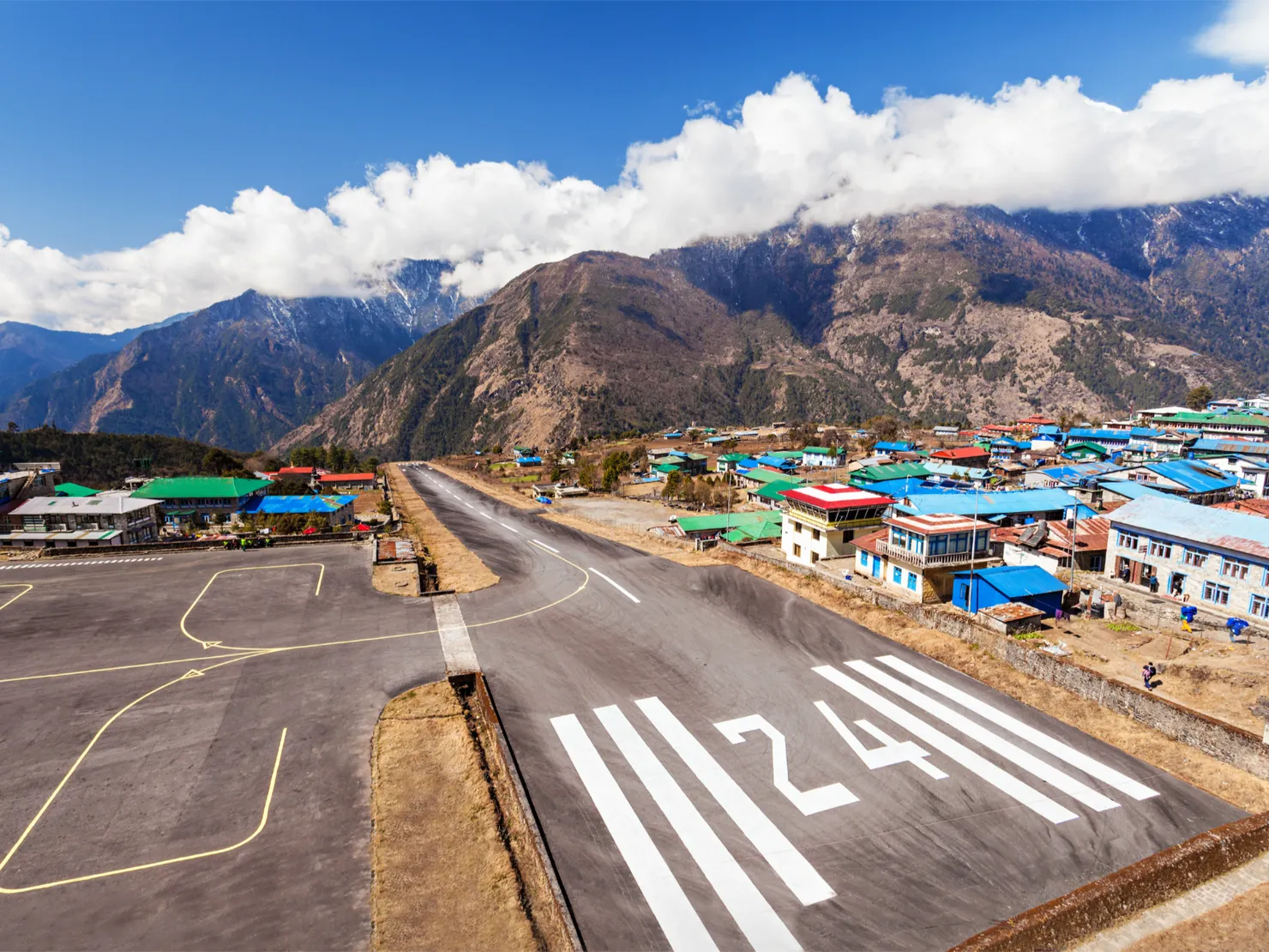
The journey starts on the legendary flight from Kathmandu to Lukla (2,840m), a short, dramatic descent onto one of the world’s steepest mountain airstrips. From here the trail drops through Cheplung and Ghat along the Dudh Koshi river to Phakding (2,610m), a gentle half-day walk that eases you into the rhythm of the trek.
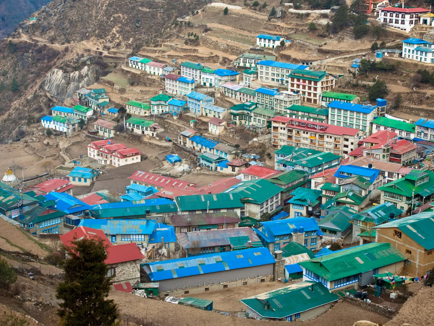
Namche Bazaar: The Khumbu Capital
The second day wins steeply to Namche Bazaar (3,440m), the bustling heart of the Khumbu, crossing suspension bridges fluttering with prayer flags and passing the Sagarmatha National Park checkpoint at Monjo. Namche holds the last reliable ATMs and espresso bars before the trails go quiet, but more importantly it is home to your first acclimatization day, with a hike up to the Everest View Hotel (3,880m) for the first panorama of the big peaks.
Tengboche: The Monastery in the Clouds
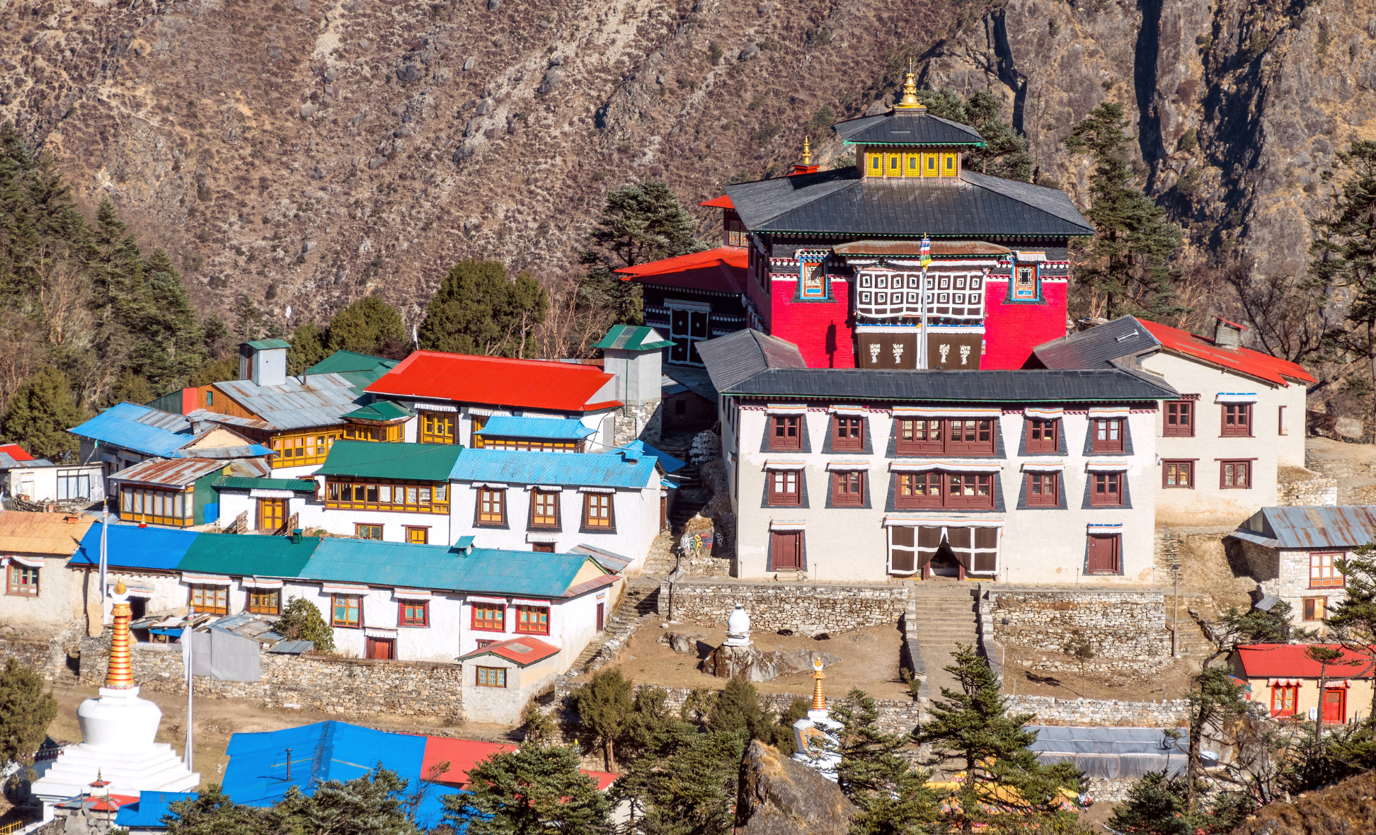
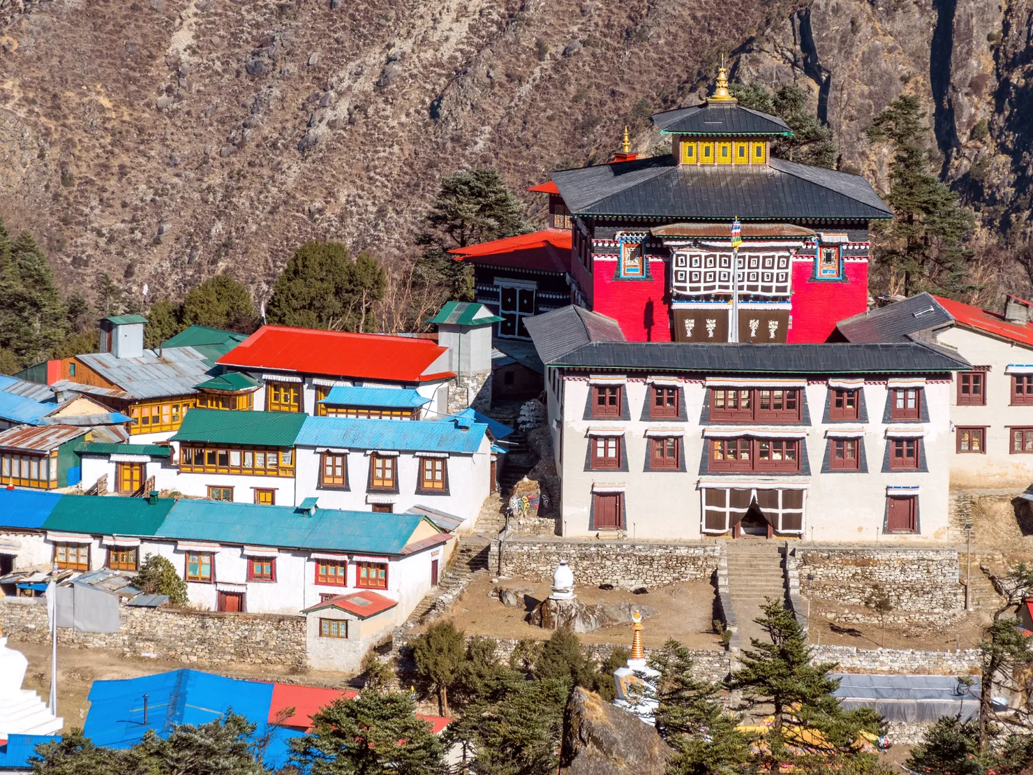
From Namche the trail rolls down to the Dudh Koshi and climbs through rhododendron forest to Tengboche (3,860m), where the region’s most important monastery sits beneath a tremendous backdrop of Ama Dablam and Everest. Evening prayers here, with the mountains turning gold outside the windows, are a highlight of the whole trek.
Dingboche: The Second Acclimatization
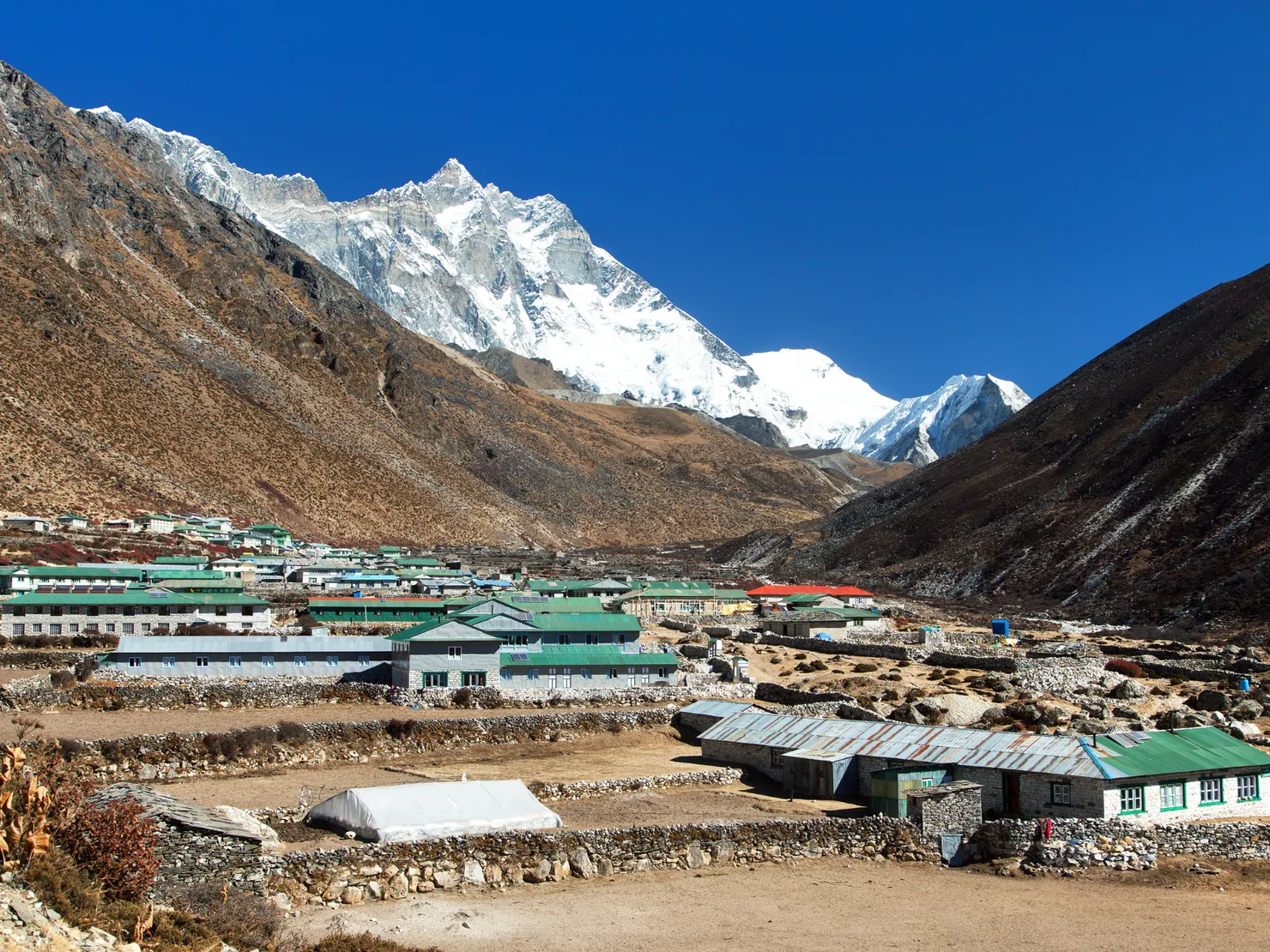
Continuing past Pangboche and its ancient monastery, the trail opens into the wide Imja valley at Dingboche (4,410m). A rest day here includes a hike up Nangkartsang (5,083m) for views of Makalu’s south face and Lhotse, an essential step above 4,500m before the first pass.
Chhukung & Kongma La: The First Pass
A short lateral day brings you to Chhukung (4,730m), a compact settlement at the foot of Island Peak, the staging point for the crossing of Kongma La (5,535m), the highest and most strenuous of the three passes. The climb climbs steadily over glacier moraine and scree before a spectacular crest with Everest, Lhotse, and Ama Dablam arranged around you; the descent drops directly toward Lobuche.
Lobuche to Everest Base Camp & Kala Patthar
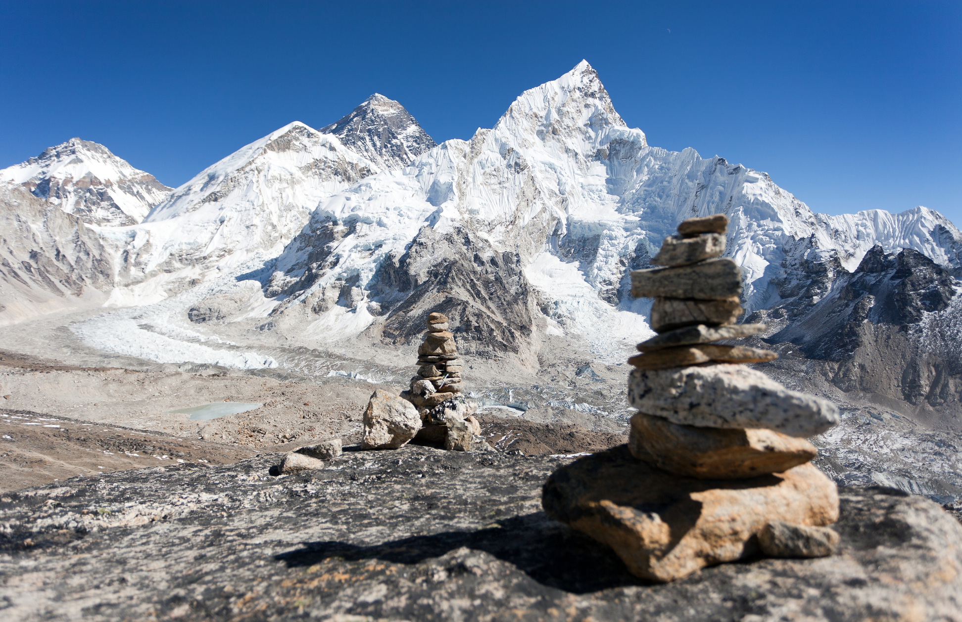
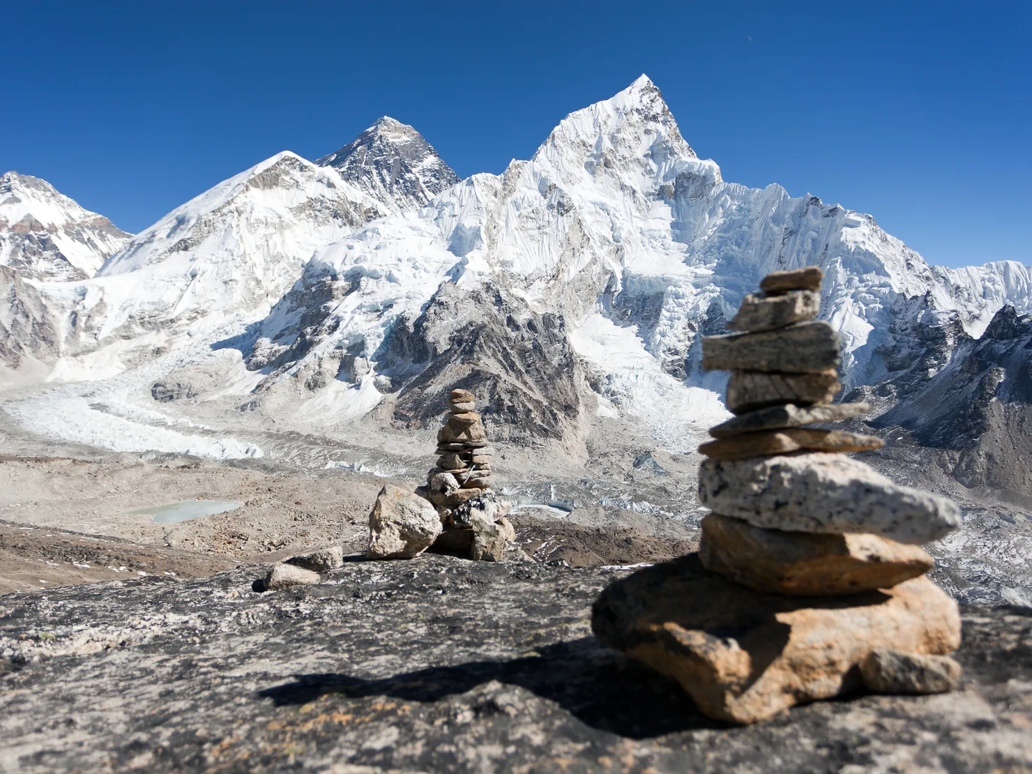
After the pass, the route joins the classic EBC trail through Lobuche (4,940m) and Gorak Shep (5,170m), the last settlement before base camp. You spend a day walking the Khumbu Glacier moraine to Everest Base Camp (5,364m) beneath the icefall that climbers navigate to reach the summit. The next morning starts before dawn for the grind up Kala Patthar (5,545m), the legendary viewpoint where the first light strikes Everest itself.
Cho La: The Crux Pass
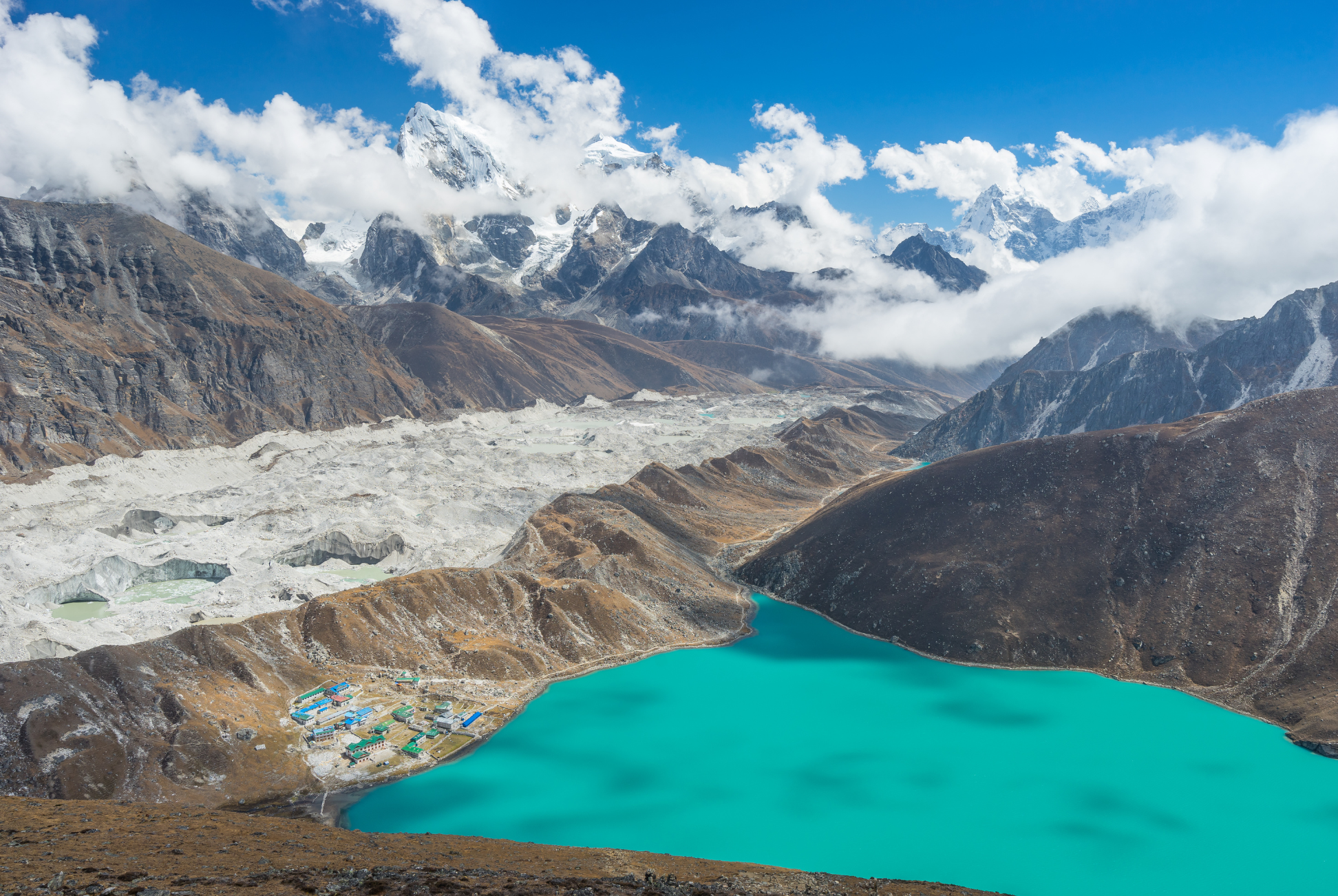
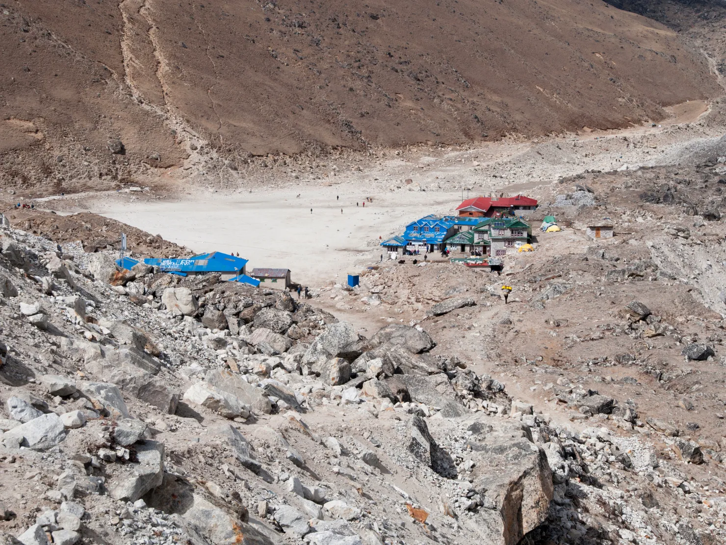
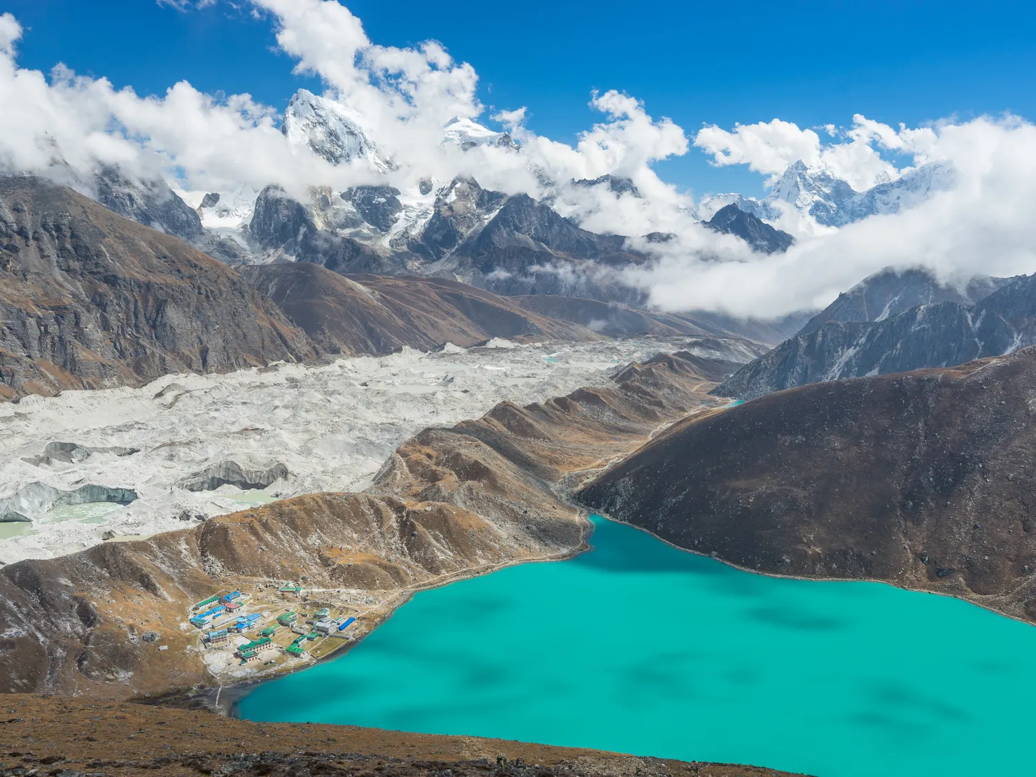
From Lobuche the trail turns off the main EBC route through Dzongla (4,830m) and up the steep, loose slopes of Cho La (5,420m). Snow and ice conditions vary, so follow your guide’s assessment of the route and any traction needed. Beyond the pass, the turquoise Gokyo lakes appear below the glacier. The descent drops to Thagnak (4,700m), a small cluster of lodges beside the Ngozumpa Glacier.
Gokyo & Gokyo Ri: The Turquoise Heart
From Thagnak you cross the Ngozumpa Glacier and walk the moraine past the first and second lakes to Gokyo (4,790m), a hamlet on the shore of the vivid third lake. A pre-dawn climb of Gokyo Ri (5,357m) delivers the trek’s signature panorama: Everest, Lhotse, Makalu and Cho Oyu all visible at once, with the lakes glowing turquoise in the valley below.
Renjo La & Thame: The Quiet Side
The final pass, Renjo La (5,360m), climbs steeply above Gokyo and is often called the most beautiful of the three: from its crest you look back across the lakes to Cho Oyu and ahead down the Bhote Koshi valley toward the Tibetan border. The long descent leads to the remote village of Lungden (4,380m) and then Thame (3,800m), a Sherpa settlement circled by glaciers and home to the region’s oldest gompas. From Thame the trail returns to Namche, closing the loop before the descent to Lukla.
Itinerary
1Lukla to Phakding
Begin walking from Lukla (2,840m). Descend through Cheplung and Ghat along the Dudh Koshi river valley to Phakding (2,610m). A gentle first day beside glaciers and tea shops.
2Phakding to Namche Bazaar
Cross the Dudh Koshi on a series of suspension bridges, pass the Sagarmatha National Park checkpoint at Monjo, then make the steep final climb to Namche Bazaar. Your first full views of Everest arrive with the rooftops.
3Acclimatization in Namche
Hike to the Everest View Hotel (3,880m) for a panorama of Everest, Lhotse, and Ama Dablam, and explore Khumjung village and the Sherpa Culture Museum. Return to Namche. This acclimatization day is the foundation for the passes ahead.
4Namche to Tengboche
Drop to the Dudh Koshi bridge and climb through rhododendron forest to Tengboche (3,860m). Visit the famous monastery, ideally for evening prayers beneath Ama Dablam.
5Tengboche to Dingboche
Descend to Debuche, pass the historic monastery at Pangboche, then follow the wide Imja valley to Dingboche (4,410m), surrounded by towering peaks.
6Acclimatization in Dingboche
Climb Nangkartsang (5,083m) for views of Makalu and the Lhotse south face, then return to Dingboche. The extra day above 4,400m is critical before Kongma La.
7Dingboche to Chhukung
A short but significant gain to Chhukung (4,730m) at the foot of Island Peak. Rest for tomorrow’s pass. Watch the light on Ama Dablam and Lhotse in the evening.
8Chhukung to Kongma La to Lobuche
The first and highest pass. Climb steadily over glacier moraine and loose scree to Kongma La (5,535m), then descend toward the Dudh Koshi and overnight at Lobuche (4,940m). Start early; weather closes in fast above 5,000m.
9Lobuche to Everest Base Camp and Gorak Shep
Walk the Khumbu Glacier moraine to Everest Base Camp (5,364m), beneath the icefall that climbers navigate to the summit. In spring you may share the camp with expedition teams. Return along the moraine to Gorak Shep (5,170m) for the night.
10Kala Patthar Sunrise, Descend to Dzongla
Pre-dawn climb of Kala Patthar (5,545m) for a classic sunrise view of Everest, then descend via Gorak Shep and Lobuche before turning up the valley to Dzongla (4,830m). This is a long day; distance and time depend on the viewpoint reached and overnight lodge.
11Dzongla to Cho La to Thagnak
Climb Cho La (5,420m) over steep, rough terrain; snow or ice may make the crossing more challenging. Follow your guide’s current route and safety advice, then descend towards Thagnak (4,700m), beside the Ngozumpa Glacier.
12Thagnak to Gokyo
Cross the Ngozumpa Glacier and follow the moraine past the second lake to Gokyo (4,790m), on the shore of the vivid third lake. Settle in early and watch the sun fall on Cho Oyu.
13Gokyo Ri Sunrise and Upper Lakes
Pre-dawn climb of Gokyo Ri (5,357m) for the panorama that rivals Kala Patthar: Everest, Lhotse, Makalu and Cho Oyu above the lakes. Afternoon walk to the fourth and fifth lakes along the Ngozumpa Glacier, with a rare unobstructed view of Everest.
14Gokyo to Renjo La to Lungden
Climb the steep switchbacks of the final pass, Renjo La (5,360m). The view west to the Tibetan border and back across the lakes is the best of the trek. Descend to the remote settlement of Lungden (4,380m).
15Lungden to Thame
Descend the Bhote Koshi valley to Thame (3,800m), a glacier-ringed Sherpa village with ancient gompas and the region’s famous school. A quiet, cultural finish to the high passes.
16Thame to Namche Bazaar
Rejoin the Khumbu main trail and climb back to Namche Bazaar, completing the loop. Celebrate among the cafes and bakeries with the harder miles behind you.
17Namche to Lukla
The final walking day descends through Monjo and the park checkpoint, crosses the Dudh Koshi bridges one last time, and climbs out to Lukla. A well-earned feast ends the trek.
Alternative Itineraries
- Clockwise direction: Most groups do the loop clockwise, hitting Gokyo and Cho La first and finishing through Kongma La and the EBC valley. Both directions work; counter-clockwise saves the two most-viewed highlights (EBC and Kala Patthar) for the second half.
- Slower pace (20-21 days): Add a rest day at Gokyo and at Thame for a gentler rhythm, or budget an extra day above 5,000m to wait out weather on the passes.
- Shortened EBC-plus loop (14 days): Cut Cho La and Renjo La by returning from Gokyo through Dole to Namche, keeping Kongma La and the Gokyo lakes in the mix.
Route Map
Elevation Profile
Logistics & Support
Accommodation
Teahouses line the entire 170km loop, including remote Thagnak and Lungden. Rooms are simple with twin beds and thin walls; dining rooms have wood-burning stoves and serve a hearty set menu. Above 4,000m, hot showers and charging cost extra and may be unavailable, especially at Thagnak and Lungden. Book ahead in October, when beds at Lobuche, Gorak Shep, and Gokyo fill fast.
Guides & Porters
Three Passes is covered by Nepal’s current guide and agency-issued TIMS requirements, and checkpoints may verify permits and guide credentials. Your guide’s judgment on weather, snow, and route conditions around Cho La is invaluable. Porter capacity and rates vary by agency, season, and load.
Permits
- Sagarmatha National Park Entry Permit: NPR 3,000 for foreign visitors under the current Nepal Tourism Board fee table.
- Khumbu Pasang Lhamu Rural Municipality fee: confirm the current fee and collection point with your agency or the municipality.
- Agency-issued TIMS card: NPR 2,000 for non-SAARC trekkers under current Nepal Tourism Board guidance.
The route is listed by Nepal Tourism Board among those requiring agency-issued TIMS. Arrange the required documents through a registered agency and carry your passport; confirm checkpoint procedures before travel.
High-altitude trekking and rescue insurance is strongly recommended. Check that your policy covers the elevations on your itinerary, emergency evacuation, and altitude-related illness; verify exclusions and weather-related flight cover with your insurer.
Budget
| Item | Cost |
|---|---|
| Permits | ~$45-50 |
| Guide | $25-40/day |
| Porter | $25-30/day |
| Teahouse room | $3-8/night |
| Meals | $3-6/meal |
| Lukla flight (round trip) | $400-440 |
| Daily budget | $40-70/day |
Getting There and Back
Getting to the trailhead: Fly from Kathmandu to Lukla; during some peak-season periods, flights may operate from Ramechhap instead. Confirm the departure airport and transfer plan, and allow a buffer for weather delays.
Returning from the trail: The walking itinerary ends in Lukla. Fly back to Kathmandu when conditions allow and leave spare days before onward travel, as cancellations can disrupt tight connections.
Weather & Seasons
The best seasons are Autumn (mid-September to November) and Spring (March to May).
| Season | Conditions |
|---|---|
| Autumn (Sep-Nov) | Stable, dry, clearest skies; the passes are snow-free and the lakes electric. Peak crowds. |
| Spring (Mar-May) | Warmer days, rhododendrons in bloom, but lingering snow and ice on Cho La and Kongma La. |
| Winter (Dec-Feb) | Very cold (-20°C) with deep snow on the passes; for experienced winter trekkers only. |
| Monsoon (Jun-Aug) | Clouds, mud, and leeches; poor visibility and unsafe pass conditions. Not recommended. |
Autumn is often a reliable choice, with crisp, dry weather and clear views, though conditions can change quickly at altitude. Spring brings more color on the lower trail, while snow may linger on the high passes. Ask locally about current conditions and suitable equipment. Winter conditions can be severe and are best left to experienced, well-equipped trekkers with current local advice.
Tips
- Start before daylight on pass days. Weather above 5,000m deteriorates after midday; every pass crossing should reach the crest by late morning.
- Take the acclimatization days seriously. The two rest days are what separate a highlight reel from a struggle. Never skip the Namche and Dingboche hikes.
- Ask about pass conditions before setting out. Snow and ice on Cho La vary by season and year; your guide can advise whether traction devices are appropriate for the current route.
- Book teahouses ahead in October. Beds at Lobuche, Gorak Shep, Thagnak, and Gokyo fill by afternoon; a guide handles reservations while you walk.
- Bank money in Namche. There are no reliable ATMs beyond the Khumbu capital, so budget the full trek in cash (US dollars and rupees) before you leave it.
- Fly Lukla in the morning. Fog builds through the day; the earliest flights are the most reliable, and it is worth a 3am drive from Kathmandu to make the first of them.
- Savor the quiet side. The Renjo La descent through Lungden and Thame is the least-traveled section of the whole trek. Slow down; the views and villages are the reason this loop beats a double back.
- Respect mountain tradition. Pass clockwise around chorten and mani walls, remove shoes at the monasteries of Tengboche and Thame, and keep the lakes and passes free of litter.
Frequently Asked Questions
Planning
When is the best time to do the Three Passes trek?
The best seasons are Autumn (September-November) for the clearest, most stable weather, and Spring (March-May) for mild temperatures and rhododendron blooms. Winter is possible for experienced, well-equipped trekkers but adds dangerous snow conditions on the passes. Monsoon (June-August) is not recommended; rain, mud, and cloud make the high passes risky.
How long does the Three Passes trek take?
The itinerary shown has 17 days on the trail, including acclimatization days in Namche and Dingboche. Allow extra time for flights to and from Lukla, weather buffers and any slower-paced rest days.
How difficult is the Three Passes trek?
This is one of Nepal's toughest teahouse treks. You cross three passes above 5,350m (Kongma La 5,535m, Cho La 5,420m, Renjo La 5,360m), climb Kala Patthar at 5,545m, and walk 170km over 17 days. Prior high-altitude trekking experience is strongly recommended. Kongma La in particular involves steep, glacier-riven scree.
Do I need to book teahouses in advance?
In peak season (October-November) book ahead through your agency or guide, especially at Lobuche, Thagnak, and Lungden where beds are limited. Teahouses cover the entire route, but amenities thin out between Cho La and Gokyo, and again at Lungden on the Renjo La approach.
Difficulty & Altitude
How far do you walk each day?
Daily distances range from 5km on acclimatization days to 19km on the final descent to Lukla. Most days fall between 8-13km. The passes make the walking more important than the distance: expect 7-8 hours of sustained climbing and descending on pass days.
Which pass is the hardest?
Kongma La (5,535m) is generally considered the most demanding: a long, steep approach over loose scree and glacier moraine, often with snowfields near the top. Cho La (5,420m) can be the crux, with steep, rough ground and potentially icy or snowy sections. Conditions vary by season and year; ask your guide about the current route before setting out.
What about altitude sickness?
You will spend 7-8 nights above 4,500m and every route crosses at least 5,350m. The itinerary builds in acclimatization days in Namche and Dingboche. Climb slowly, sleep low where practical, stay hydrated, and descend immediately if symptoms persist. This is not a trek for altitude rookies.
Do I need technical gear for the passes?
No technical climbing gear is normally used on the standard trekking route, but snow and ice can make the passes hazardous. Ask your guide shortly before the trek whether traction devices are appropriate for current conditions, and follow local advice on route choice. Trekking poles can help on steep, loose ground.
Permits & Costs
What permits do I need?
You need a Sagarmatha National Park entry permit, the Khumbu Pasang Lhamu Rural Municipality fee, and the agency-issued TIMS card required for this route. Nepal Tourism Board currently lists the park fee at NPR 3,000 for foreign visitors and TIMS at NPR 2,000 for non-SAARC trekkers. Confirm the municipal fee and current collection arrangements with your agency.
How much does the trek cost?
Budget varies with season, group size, guide service, and flight arrangements. Include the Sagarmatha entry fee, municipal fee, agency-issued TIMS, Lukla flights, meals, accommodation, and guide costs in an itemized quote. Carry cash for the trail.
Is a guide required?
Yes. Three Passes is among the routes covered by Nepal's current guide and agency-issued TIMS requirements. A licensed guide can help with weather decisions and changing trail conditions around the high passes.
Route & Navigation
What is the counter-clockwise route versus the clockwise route?
The Three Passes is a loop that can be walked either direction. Most groups go clockwise (Namche to Gokyo first, finishing via Tengboche). The counter-clockwise, Tengboche-first route heads up the classic EBC valley to Kongma La, visits Everest Base Camp and Kala Patthar, then crosses Cho La to Gokyo and exits over Renjo La through Thame. Both cross the same three passes.
Is the trail crowded?
The EBC valley sections (Tengboche to Gorak Shep) are busy in peak season, but the passes thin the crowds dramatically. From Kongma La onward and on the Renjo La descent through Thame, you will often have the trail to yourself compared with the main EBC highway.
Can I turn back if I cannot manage a pass?
Yes. The loop can be modified: skip Kongma La and walk the standard EBC route to Gorak Shep, or skip Renjo La and return from Gokyo through Dole to Namche. Your guide will adjust the route to conditions and your fitness.
Best Views & Highlights
What makes the Three Passes better than a standard EBC trek?
You complete the entire Everest region: the EBC valley, Kala Patthar's direct Everest view, the turquoise Gokyo lakes with four 8,000m peaks visible from Gokyo Ri, and the far side of Khumbu through Thame, off the main trail. It is EBC plus Gokyo plus the best viewpoints in one loop.
Is Gokyo Ri better than Kala Patthar?
Most trekkers say yes. From Gokyo Ri (5,357m) you see four 8,000m giants at once: Everest, Lhotse, Makalu, and Cho Oyu, with the Ngozumpa Glacier and turquoise lakes below. Kala Patthar is the classic closer view of Everest. On this trek you get both.
What is the best moment of the trek?
Three stand out: sunrise over the sanctuary from Kala Patthar, the first sight of Gokyo's turquoise lakes after descending Cho La, and the crossing of Renjo La, which many call the most beautiful mountain pass in Nepal, with Everest dominating the view to the southeast for the entire descent.