Check access conditions before travel
Road access and trail conditions in the Langtang region can change after severe weather, landslides, or infrastructure damage. Check current notices from local authorities, park staff, and your registered trekking agency before travelling to Syabrubesi.
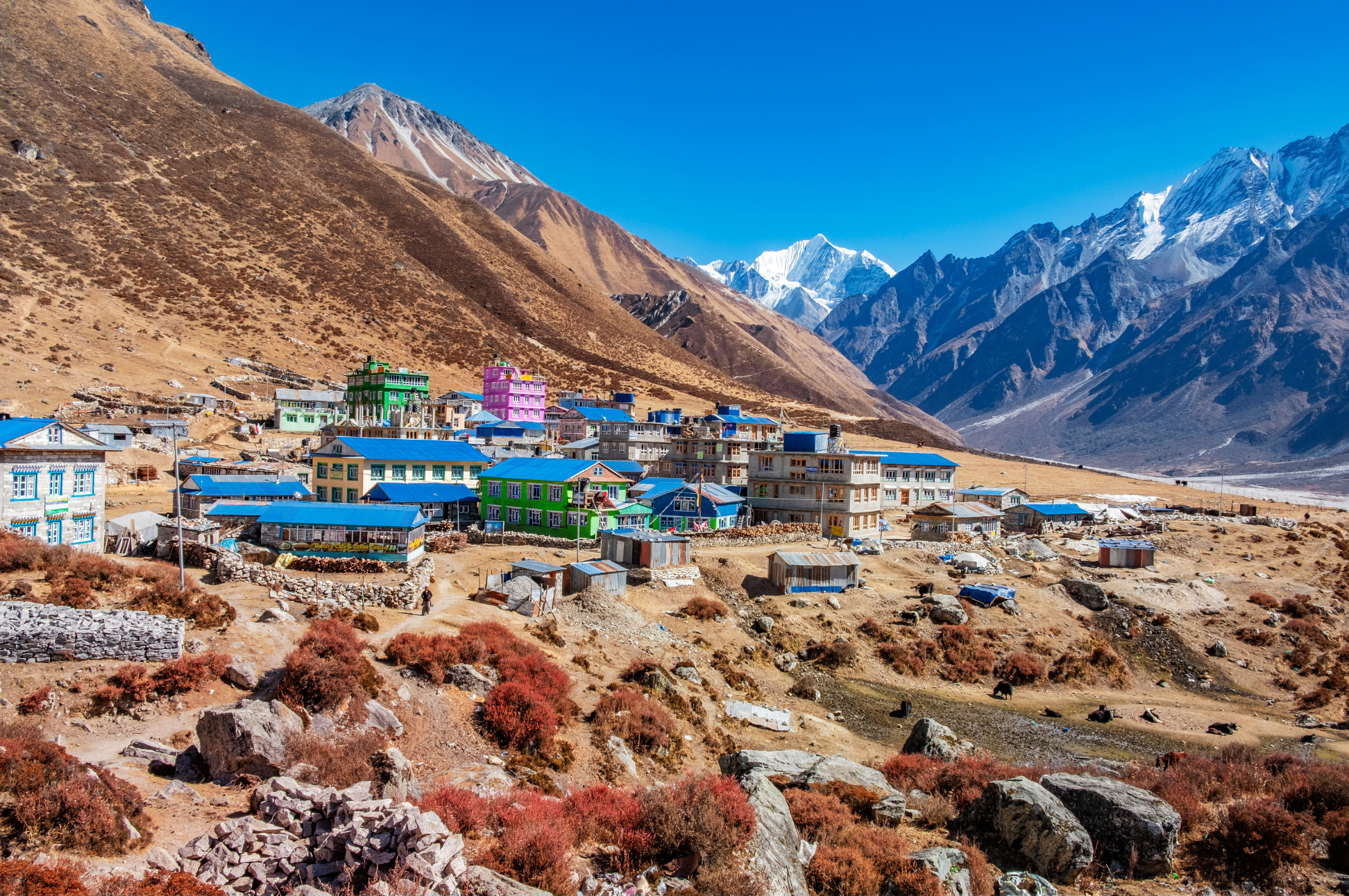
Langtang Valley
0 wishlisted0 done
Sign in to save this trek to your list.
Is This Trek for You?
Choose Langtang if you want a shorter Himalayan trek with strong cultural character, varied landscapes, and a manageable approach from Kathmandu. It suits fit beginners who are prepared for steep climbs and altitude near 5,000m on optional side hikes; skip the high viewpoints if your acclimatization or weather is poor.
Overview
Langtang Valley is often called the “valley of glaciers,” and it earns that name. Located just north of Kathmandu along the Tibetan border, this stunning glacial valley offers the most accessible major trek in Nepal. No domestic flights required, just a scenic 7-8 hour drive to the trailhead at Syabrubesi.
The valley carries deep emotional weight. The 2015 earthquake devastated Langtang Village, burying entire neighborhoods under landslides. The village has been rebuilt with remarkable resilience, and tourism income is fundamental to its recovery. Walking through Langtang Village today, you’ll see memorial chortens and a community determined to honor the past while building the future.
The trail follows the Langtang Khola through dense forests of rhododendron and oak, past traditional Tamang villages, before opening into a wide glacial valley dominated by the towering Langtang Lirung (7,227m). The highlight is Kyanjin Gompa (3,870m), a Buddhist monastery surrounded by massive peaks. From here, you can climb Tserko Ri (4,984m) for one of the best panoramas in Nepal, a 360-degree view of Langtang Lirung, Ganesh Himal, Dorje Lakpa, and the Tibetan plateau. The easier Kyanjin Ri (4,773m) offers similar views with less effort. Both are achievable on an acclimatization day from Kyanjin Gompa.
What sets Langtang apart from other Himalayan treks is the combination of accessibility, cultural depth, and raw glacial scenery. You’ll walk through Tamang villages where prayer flags flutter above stone houses, taste yak cheese fresh from the Kyanjin Gompa factory, and witness a landscape shaped by ice and resilience. The valley feels intimate compared to the busier EBC and Annapurna routes, with fewer trekkers and a stronger sense of connection to the land and its people.
Route & Key Stops
Syabrubesi: The Starting Point
Syabrubesi (1,550m) is the trailhead for the Langtang trek, accessible from Kathmandu by bus or jeep (7-8 hours). The drive follows the scenic Trishuli River valley with views of terraced farmland and mountain ridges. Syabrubesi sits at the confluence of the Langtang and Bhote Koshi rivers, surrounded by dense subtropical forest. The village has a relaxed feel, with a few teahouses and a checkpoint where your permits are verified.
Bamboo & Lama Hotel: Through the Forest
The trail from Syabrubesi climbs through dense forest of oak, bamboo, and rhododendron along the Langtang Khola. Bamboo (2,130m) is a small settlement deep in the forest. Keep your eyes peeled for red pandas and Himalayan tahr in the canopy above. Lama Hotel (2,380m) is a simple teahouse settlement and the usual overnight stop on day two. The forest here is thick and humid, a world away from the glacial valley above.
Langtang Village: Rebuilding After the Earthquake
Langtang Village (3,430m) was one of the worst-hit areas in the 2015 earthquake. The entire village was buried by a massive landslide. It has been rebuilt with traditional Tamang architecture, and visiting here is a moving experience. Memorial chortens honor those who were lost, and your visit directly supports the community’s recovery. The new settlement sits on more stable ground above the old village site, with mountain views that stretch across the valley.
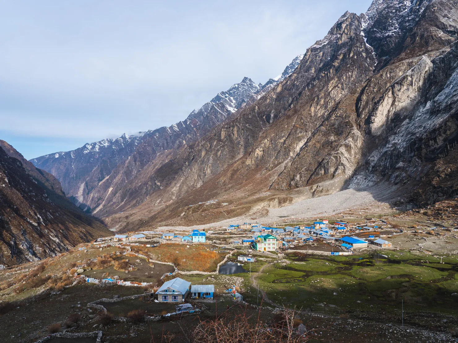
Kyanjin Gompa: The Heart of the Valley
Kyanjin Gompa (3,870m) is the furthest settlement in the valley and the base for exploring the upper glacial landscape. The monastery, cheese factory, and surrounding peaks make this an unforgettable stop. The cheese factory produces excellent yak cheese. Try it fresh. From Kyanjin Gompa, you can walk up the glacial moraine to see the spectacular ice faces and tumbling glaciers of Langtang Lirung. The valley floor here is wide and barren, scattered with glacial debris and surrounded by towering peaks.
Tserko Ri & Kyanjin Ri: The Viewpoints
Tserko Ri (4,984m) is the high point of the trek, a steep 3-4 hour climb from Kyanjin Gompa for a 360-degree panorama of Langtang Lirung, Ganesh Himal, Dorje Lakpa, and the Tibetan plateau. Kyanjin Ri (4,773m) is a shorter, easier alternative with similar views. Both are best at sunrise when the light paints the peaks in golden hues. The climb is steep but well-marked, and the reward at the top is worth every step.
The Descent
The return retraces the valley floor through Langtang Village, Lama Hotel, and Bamboo before reaching Syabrubesi. The lower altitude and familiar scenery make the descent faster and more relaxed. Many trekkers notice details they missed on the way up, a different angle on a peak, a bird they hadn’t spotted, the way the light falls differently in the afternoon.
Itinerary
1Syabrubesi to Lama Hotel
Climb through oak and rhododendron forest along the Langtang Khola. The trail passes through landslide-prone sections with views of Langtang Lirung ahead. Watch for red pandas and Himalayan tahr in the forest. Lama Hotel is a simple teahouse settlement.
2Lama Hotel to Langtang Village
Continue up the valley through bamboo and rhododendron forest. The valley widens and Langtang Lirung dominates the view. Langtang Village was rebuilt after the 2015 earthquake and showcases traditional Tamang architecture.
3Langtang Village to Kyanjin Gompa
Cross the glacial moraine into the wide upper valley. The landscape opens dramatically with Langtang Lirung, Kimshung, and Dorje Lakpa surrounding you. Visit the cheese factory and the ancient Kyanjin Gompa monastery.
4Tserko Ri & Kyanjin Gompa
Acclimatization day with the highlight of the trek. Climb Tserko Ri (4,984m) for a 360-degree panorama of Langtang Lirung, Ganesh Himal, Dorje Lakpa, and the Tibetan plateau. Alternatively, climb the easier Kyanjin Ri (4,773m). Explore the valley and glacier.
5Kyanjin Gompa to Lama Hotel
Retrace steps through Langtang Village and down the valley. The descent is faster at lower altitude. Enjoy the warmer temperatures and thicker air in the forested lower valley.
6Lama Hotel to Syabrubesi
Continue descent through the forest and along the Langtang Khola back to Syabrubesi. Final night on the trail. The drive back to Kathmandu is tomorrow.
Alternative Itinerary
The itinerary shown takes 6 days on foot. Add trekking days to explore the upper valley at a gentler pace; combining Langtang with the Gosaikunda trek adds several more route days. The road transfers to and from Syabrubesi are described separately below. See our other trek guides for alternatives if regional access is disrupted.
Route Map
Elevation Profile
Logistics & Support
Getting There and Back
Getting to the trailhead: The road journey from Kathmandu to Syabrubesi usually takes 7-8 hours, but delays, repairs and weather can extend it. Arrange a bus, shared jeep or private vehicle, and consider staying overnight before the first walk.
Returning from the trail: From Syabrubesi, return to Kathmandu by road. Allow a buffer before onward flights or other fixed connections.
Accommodation
Teahouses line the entire route. They’re simple but cozy, locally run, with warm dining rooms and basic twin bedrooms. Hot showers, Wi-Fi, and device charging are available for small extra fees ($2-5 each). The higher you go, the more basic the facilities become. Bring a good sleeping bag rated to -15°C. Rooms have no heating above 3,000m.
Guides & Porters
Nepal Tourism Board lists Langtang routes among those requiring a licensed guide and agency-issued TIMS. Check current procedures with your registered trekking agency before departure. A local guide can help with navigation, Tamang cultural context, and changing trail conditions. Porter capacity and rates vary by agency and route.
Permits
Two permits cover the trek (your trekking agency can arrange both):
- Langtang National Park Entry Permit: NPR 3,000 for foreign visitors under the current Nepal Tourism Board fee table.
- Agency-issued TIMS card: NPR 2,000 for non-SAARC trekkers under current NTB guidance for listed routes.
Carry your passport, two passport-sized photos, your insurance policy number, and cash in Nepali rupees.
High-altitude trekking and rescue insurance is strongly recommended. Check that your policy covers the elevations on your itinerary, emergency evacuation, and altitude-related illness:
- Emergency helicopter evacuation and rescue up to 6,000m (20,000 ft)
- Hospitalization and treatment for Acute Mountain Sickness (AMS), HAPE, and HACE
- Trip cancellation coverage
Permit counters do not universally require proof of insurance; carry your policy and emergency contact details for your own safety.
Budget
| Item | Cost |
|---|---|
| Permits (Park + TIMS) | ~$50 |
| Guide | $25-40/day |
| Teahouse room | $3-8/night |
| Meals | $4-7/meal |
| Kathmandu-Syabrubesi bus | $10-15 each way |
| Daily budget | $25-50/day |
Weather & Seasons
The best seasons are Spring (March-May) and Autumn (September-November).
| Season | Conditions |
|---|---|
| Spring (Mar-May) | Warming temperatures, rhododendrons in bloom in the lower forest, some haze |
| Autumn (Sep-Nov) | Stable, dry weather with crystal-clear mountain views, peak season |
| Winter (Dec-Feb) | Very cold (down to -20°C at Kyanjin Gompa), heavy snow possible, quiet trails |
| Monsoon (Jun-Aug) | Heavy rain, leeches, landslides, dangerous trail conditions |
Autumn offers the clearest skies and most reliable weather. Spring is warmer but hazier. Winter treks are possible but extreme cold makes the upper valley challenging. Monsoon treks are not recommended.
Tips
- Climb Tserko Ri at sunrise. The panorama is best in early morning light.
- Bring cash. There are no ATMs beyond Syabrubesi.
- Respect the memorial chortens. The 2015 earthquake devastated this valley.
- Try yak cheese. Kyanjin Gompa’s cheese factory produces excellent yak cheese.
- Take your time ascending. Altitude sickness is a real risk above 3,500m.
- Budget for extra days. Weather delays are common, especially in spring.
- Pack light. Tea houses provide bedding and meals, so you don’t need camping gear.
Frequently Asked Questions
Planning
When is the best time to do the Langtang Valley trek?
The best seasons are Spring (March-May) for warming temperatures and blooming rhododendrons in the lower forest, and Autumn (September-November) for stable, dry weather and the clearest mountain views. Winter (December-February) is very cold (down to -20°C at Kyanjin Gompa) with heavy snow possible, and monsoon (June-August) brings rain, leeches, and dangerous trail conditions.
How long does the Langtang Valley trek take?
The itinerary shown has 6 days on foot, including the Tserko Ri viewpoint day. Add trekking days for a slower pace or more time in the upper valley; road journeys to and from Syabrubesi are separate. Some trekkers combine Langtang with the Gosaikunda lakes trek, adding several route days.
How much does the Langtang Valley trek cost?
Budget depends on season, transport, and guide service. The current Nepal Tourism Board fee table lists the Langtang National Park entry permit at NPR 3,000 for foreign visitors; TIMS is NPR 2,000 for non-SAARC trekkers on routes where required. Get a current transport and service quote before departure, and carry cash beyond Syabrubesi.
Do I need to book teahouses in advance?
Yes, especially during peak season (October-November) when demand is high at Kyanjin Gompa and Langtang Village. Booking ahead ensures you have a room after a long day of trekking. Your guide or trekking agency can handle reservations.
Difficulty & Fitness
How difficult is the Langtang Valley trek?
The trek is considered moderate. The main challenge is the altitude on Tserko Ri (4,984m) and the steady climbing over 3-4 days. Good physical fitness is recommended, but no technical skills are required. Previous hiking experience helps, and preparation with regular cardio 2-3 months before the trip is ideal.
How far do you walk each day on the Langtang trek?
Daily distances vary from 7 km on shorter days to 21 km on descent days. Most days fall between 10-14 km. The total round trip covers approximately 80-100 km (50-62 miles). Your porter carries the main bag (up to 10 kg) so you only need a daypack.
Do I need trekking poles for Langtang?
Trekking poles are highly recommended. They reduce strain on your knees during the long descent days from Kyanjin Gompa back to Syabrubesi, improve balance on rocky sections, and help with river crossings on the forest trail.
Permits & Budget
What permits do I need for the Langtang trek?
You need a Langtang National Park Entry Permit. Nepal Tourism Board lists Langtang among routes requiring a licensed guide and agency-issued TIMS card. Its current fee table lists park entry at NPR 3,000 for foreign visitors and TIMS at NPR 2,000 for non-SAARC trekkers. Confirm fees before departure.
Is travel insurance necessary for Langtang?
Travel insurance is strongly recommended. Check that your policy covers trekking at the elevations on your itinerary, emergency helicopter evacuation, and altitude-related illness. Confirm exclusions and any required documentation directly with your insurer.
Can I trek Langtang without a guide?
Nepal Tourism Board lists Langtang routes among those requiring a licensed guide and agency-issued TIMS. Arrange a guide through a registered trekking agency and confirm current checkpoint procedures. You can still trek privately rather than joining a group.
Altitude & Safety
How do I prevent altitude sickness on the Langtang trek?
Ascend gradually and take acclimatization seriously. The itinerary includes steady altitude gain over 4 days before reaching Kyanjin Gompa (3,870m). On the acclimatization day, hike to Tserko Ri or Kyanjin Ri to test your body at higher altitude, then return to sleep lower. Follow the golden rule: climb high, sleep low. If you experience severe headache, nausea, or confusion, descend immediately.
How high does the Langtang trek go and can I handle the altitude?
The highest point is Tserko Ri at 4,984m (16,352 ft). Kyanjin Gompa sits at 3,870m and is the highest sleeping point. The trailhead at Syabrubesi is 1,550m. Most healthy people can manage the altitude with proper acclimatization, but altitude affects everyone differently regardless of fitness. Diamox (acetazolamide) can help and is available with a doctor's prescription.
Is it safe to trek Langtang after the 2015 earthquake?
Yes. Langtang Village has been fully rebuilt with strong community support. The trail is safe and well-maintained. Visiting Langtang directly supports the local recovery. Memorial chortens honor those lost, and the community has welcomed trekkers back with warmth and resilience.
Logistics
What is the accommodation like on the Langtang trek?
Teahouses line the entire route from Syabrubesi to Kyanjin Gompa. They are simple but cozy, family-run lodges with warm dining rooms and basic twin bedrooms. Hot showers, Wi-Fi, and device charging are available for small extra fees ($2-5 each). Facilities become more basic above 3,000m, and rooms have no heating. Bring a good sleeping bag rated to -15°C.
What should I pack for the Langtang trek?
Essentials include an insulated down jacket (temperatures drop to -20°C at Kyanjin Gompa), a sleeping bag rated to -15°C, trekking poles, UV-protective sunglasses, a headlamp with spare batteries, a hydration system with water purification, a waterproof shell jacket and pants, thermal base layers, a warm hat, gloves, a buff, and SPF 50+ sunscreen. Keep your porter bag under 10 kg.
How do I get to the Langtang trailhead?
The trek starts at Syabrubesi, reachable by bus or jeep from Kathmandu (7-8 hours). The drive follows the scenic Trishuli River valley through terraced farmland and mountain ridges. There is no flight required, which makes Langtang the most accessible major trek from Kathmandu.
What cultural customs should I be aware of?
The Langtang region is home to Tamang people with strong Tibetan Buddhist traditions. Remove your shoes before entering monasteries and always walk clockwise around chortens, mani walls, and prayer wheels. Dress modestly in villages and religious sites. The local cheese factory at Kyanjin Gompa is worth visiting, and trying yak cheese is a highlight.