Mardi Himal Trek
0 wishlisted0 done
Sign in to save this trek to your list.
Is This Trek for You?
Choose Mardi Himal if you want a short, accessible trek with big Annapurna views and a fast transition from forest to high ridge. It suits fit beginners who can handle steep daily climbs and a high viewpoint; it is less suitable if you need gradual acclimatization, wide lodge choice, or guaranteed clear weather.
Overview
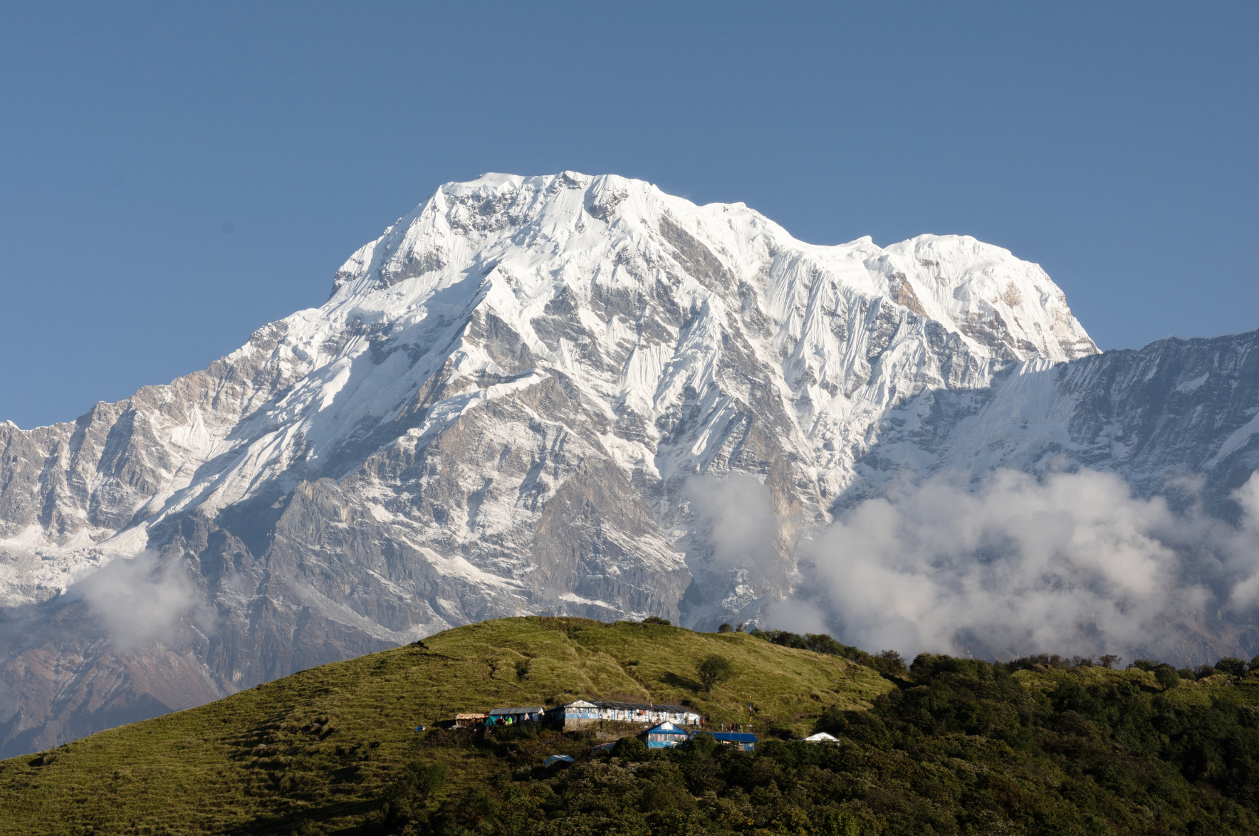
Mardi Himal is a short trek with a surprisingly big mountain finish. From the roadhead above Pokhara, the trail climbs through mossy rhododendron forest, emerges onto a high grass ridge and continues towards the shadow of Machhapuchhre—the sharply pointed mountain better known as Fishtail.
The route is compact enough for a long weekend with a strong pace, but it rewards a slower approach. Forest Camp and Low Camp are not merely stops on a schedule; they are the transition from green middle hills to open alpine country. Above High Camp, the trail narrows and the peaks seem to move closer with every switchback.
Mardi Himal is often described as an easy alternative to the bigger Annapurna treks. That is only partly true. The trail is non-technical and the logistics are simple, but the climb is quick, the ridge is exposed and the Upper Viewpoint sits high enough for altitude to matter. Treat the mountain seriously and the trek offers one of Nepal’s finest short panoramas.
Route & Key Stops
Kande, Australian Camp and Pothana
Most itineraries leave Pokhara by road for Kande and walk through Australian Camp towards Pothana. The opening trail passes through pine and rhododendron forest, with early views of the Annapurna range between the trees. Pothana is a good first night: high enough to feel like a mountain village, but still comfortable and well supplied.
Deurali and Forest Camp
The trail climbs through dense forest to Deurali, then turns towards Forest Camp. In spring, rhododendron flowers brighten the understory; after rain, the path can be slick with mud and leaf litter. The walking is steady rather than dramatic, but the quiet is part of the appeal. You hear birds, wind and the occasional bell before you see another settlement.
Low Camp and Badal Danda
At Low Camp, the trees begin to thin and the first close views of Machhapuchhre appear. The ridge continues through open woodland and pasture towards Badal Danda, whose name means Cloud Hill. On clear afternoons, the clouds gather below the trail while the Annapurna peaks remain bright above them.
High Camp and the Upper Viewpoint
High Camp is the last substantial overnight stop. From here, a pre-dawn walk follows the ridge towards the Upper Viewpoint at about 4,200m. The trail is steep and exposed in places, with loose rock and possible snow. Turn around when weather or altitude demands it; the view from the lower ridge is still exceptional.
Sidhing and Lumre
The usual descent leaves the high ridge for Sidhing, dropping through forest on a different line from the ascent. From Sidhing, a rough road transfer reaches Lumre and then Pokhara. The descent is hard on knees, but the sudden return to warm air, terraces and village kitchens makes a satisfying close to the trek.
Itinerary
1Kande to Pothana
Begin walking at Kande, climbing through forest and stone steps towards Australian Camp. Continue along the ridge to Pothana, where the first mountain views open between the trees. Keep the afternoon easy and use it to check boots, water and layers before the longer forest days.
2Pothana to Forest Camp
Climb through Deurali and into the deep rhododendron forest. The trail undulates over roots, stones and damp leaf litter, with occasional clearings looking back towards the foothills. Forest Camp is a small cluster of lodges surrounded by trees; settle in early because the next day reaches more exposed ground.
3Forest Camp to Low Camp
The forest becomes shorter and more open as the trail climbs towards Low Camp. Look for the first uninterrupted views of Machhapuchhre and Annapurna South along the ridge. The altitude begins to make itself felt, so keep a steady pace and avoid racing the final switchbacks into camp.
4Low Camp to High Camp
Follow the open ridge through Badal Danda, where clouds often collect below the trail. The walking is shorter but exposed to wind and weather, and the path narrows as it approaches High Camp. Spend the afternoon acclimatizing rather than pushing farther; the viewpoint walk is best started early the next morning.
5High Camp to Upper Viewpoint; return to High Camp
Leave before sunrise for the Upper Viewpoint. The ridge is steep and rocky, and snow or ice can make the final section slow. On a clear morning, Machhapuchhre rises directly ahead while Annapurna South, Hiunchuli and the wider range catch the first light. Return to High Camp for breakfast and a second night at altitude, allowing a shorter descent day and flexibility if weather delays the viewpoint walk.
6High Camp to Sidhing
Descend from High Camp past Low Camp and through forest towards Sidhing. The trail is steep in places and can be slippery after rain, so trekking poles are useful. Sidhing marks the end of the walking itinerary.
Route Map
Elevation Profile
Logistics & Support
Getting There and Back
Getting to the trailhead: From Pokhara, arrange a vehicle to Kande. The drive is usually around an hour, depending on traffic and road conditions; start walking from Kande on Day 1.
Returning from the trail: From Sidhing, arrange a local jeep transfer (often via Lumre) back to Pokhara. Road and vehicle conditions can affect timing, so leave a buffer before onward connections.
Weather & Seasons
The best seasons are Autumn (October-November) and Spring (March-May).
| Season | Conditions |
|---|---|
| Autumn (Oct-Nov) | Clearest mountain views and stable ridge weather; busiest season on the lower trail |
| Spring (Mar-May) | Rhododendron blooms through the forest section, warming temperatures, some midday haze |
| Winter (Dec-Jan) | Clear but cold, with snow possible on the upper ridge; the viewpoint climb starts well before dawn |
| Monsoon (Jun-Sep) | Heavy rain, muddy trails, clouded-out views and slippery ridge sections; not recommended |
The ridge is exposed: wind and cloud can close in quickly even in season. Treat the final viewpoint as optional and turn back if visibility drops — the forest stages below are the reliable part of the walk.
Tips
- Start early for the viewpoint. Leave before dawn from Low Camp or Siding; morning is usually the clearest window.
- Build in slow days. The trek is short but climbs fast — carry warm layers, start gently and give altitude time to adjust.
- Watch the ridge weather. Cloud and wind arrive quickly; the final viewpoint is optional rather than a test of endurance.
- Leave a buffer for the jeep. Road and vehicle conditions between Sidhing and Pokhara can affect timing.
- Respect the landscape. Ask before photographing people or religious sites, keep to established paths, and carry rubbish back to a proper disposal point.
- Quiet trails reward patience. The route is close to Pokhara, but its best moments still depend on clear weather and patient walking.
Frequently Asked Questions
Planning
When is the best time to trek Mardi Himal?
Spring (March-May) and autumn (September-November) offer the best balance of clear mountain views and manageable trail conditions. Spring brings rhododendron flowers; autumn is usually crisp and dry. The monsoon is wet and cloudy, while winter can bring snow above Low Camp and High Camp.
How many days do I need?
A fast itinerary can be completed in 4-5 walking days, but 6-8 days allows a gentler ascent, better acclimatization, and time in the villages. Add a buffer day if you have a fixed international connection.
Where does the trek start and finish?
The classic route starts at Kande or nearby Pothana after a short drive from Pokhara, then climbs via Forest Camp, Low Camp and High Camp. Many trekkers descend through Sidhing or Lumre and return to Pokhara by road.
Can I combine Mardi Himal with another trek?
Yes. Mardi Himal can be combined with Poon Hill or Annapurna Base Camp, but these are separate itineraries that need careful route and permit planning. See our Poon Hill guide and Annapurna Base Camp guide to compare options.
Difficulty & Altitude
How difficult is Mardi Himal?
Moderate. The route is short and non-technical, but it climbs quickly from Pokhara's foothills to High Camp and the Upper Viewpoint. Expect steep forest paths, stone steps, narrow ridge trail and long descents.
What is the highest point?
The popular Upper Viewpoint is around 4,200m. Longer itineraries may continue towards Mardi Himal Base Camp at about 4,500m, but conditions and local guidance determine how far it is sensible to go.
Do I need technical climbing skills?
No. The standard trek is non-technical walking. Above High Camp the ridge is exposed in places, and snow or ice can make the trail more serious in winter and early spring.
Is altitude sickness a concern?
Yes. The rapid gain above 3,000m deserves respect even on a short trek. Walk slowly, drink regularly, avoid sleeping higher when symptoms worsen, and descend if you develop severe headache, confusion, unusual breathlessness or loss of coordination.
Permits & Logistics
What permits do I need?
Mardi Himal is in the Annapurna region. You need an Annapurna Conservation Area entry permit and the agency-issued TIMS card required for the Mardi Himal route. A registered trekking agency normally arranges the guide and paperwork.
Is a guide required?
Yes. Nepal Tourism Board lists Mardi Himal among the routes requiring a licensed guide and agency-issued TIMS card. Travel with a registered agency and confirm the current permit process before setting out.
Is there phone signal and electricity?
Signal and charging are more reliable lower down and less predictable at High Camp. Bring a power bank, download maps, and carry enough cash because card payments and ATMs are not dependable on the trail.
Route & Accommodation
What are the lodges like?
Forest Camp, Low Camp and High Camp have simple teahouses with shared rooms and dining rooms. Facilities become more basic as you climb, and High Camp has limited beds in busy seasons.
Is the trail crowded?
Mardi Himal is quieter than the main Annapurna Circuit and ABC routes, but its popularity has grown. Forest Camp and High Camp can be busy in October-November and around clear spring weekends.
What are the best views?
The ridge above Low Camp opens towards Machhapuchhre, Annapurna South, Hiunchuli and the Annapurna range. The Upper Viewpoint is the dramatic finish: a narrow high ridge with close, changing views as the morning light moves across the peaks.