Upper Dolpo Trek
0 wishlisted0 done
Sign in to save this trek to your list.
Is This Trek for You?
Upper Dolpo is for experienced trekkers who want remote valleys, old trading settlements and a long stretch of self-contained expedition travel. It suits people comfortable with camping, basic facilities and plans that may change with weather. It is not a first Himalayan trek: altitude, isolation and several high passes make the days demanding even without technical climbing.
Overview
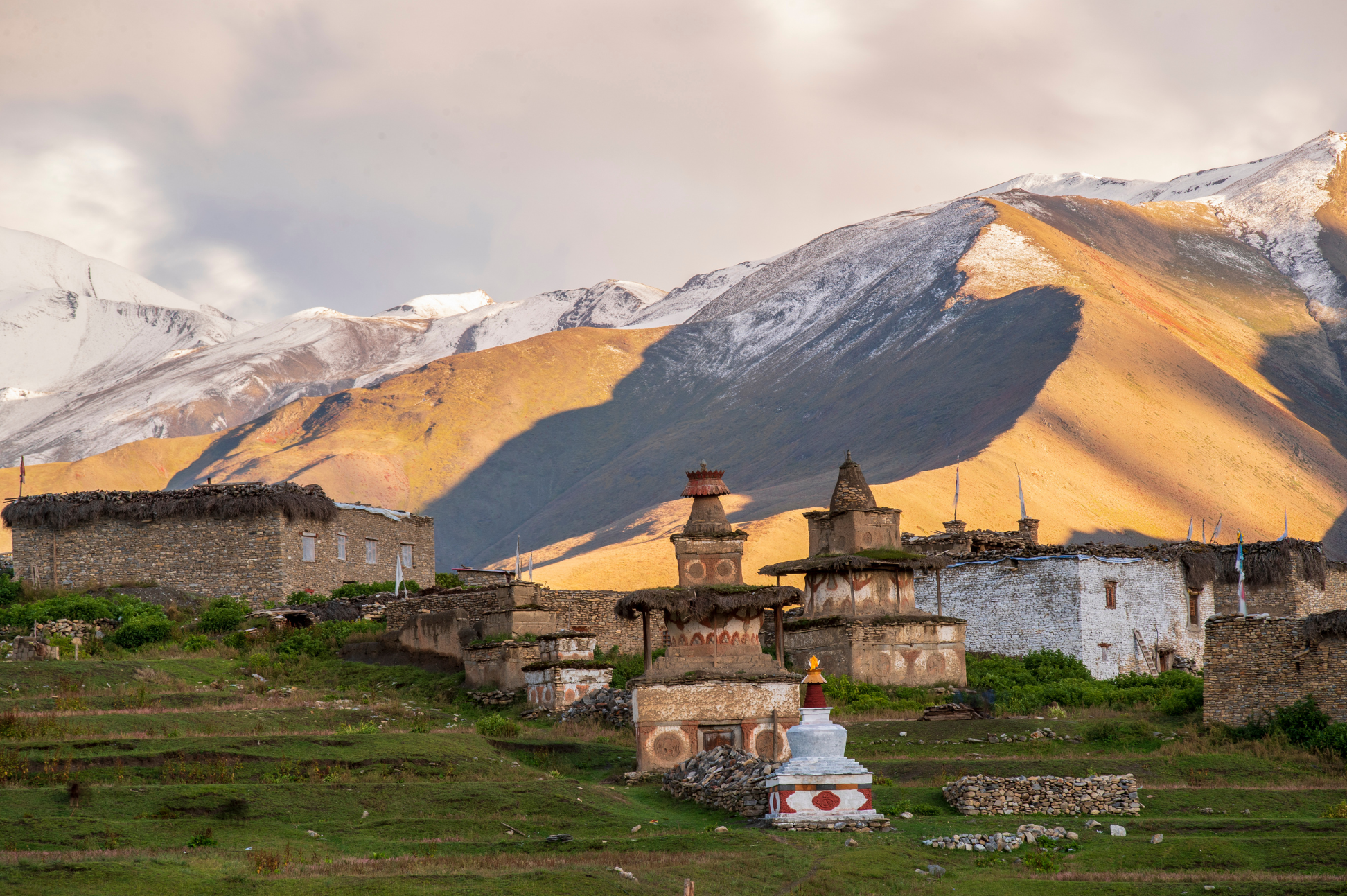
Beyond the green foothills and busy teahouse trails, Dolpo opens into a high, spare landscape of stone villages, wind-shaped hills and wide valleys beneath a deep sky. The classic Upper Dolpo circuit links the turquoise edge of Phoksundo Lake with the settlements around Shey Gompa, Saldang and Dho Tarap. Between them lie long, quiet stages and high passes where the trail can be little more than a line across scree and snow.
This is a journey measured in logistics as much as scenery. Juphal’s small airstrip is the usual doorway; beyond it, food, tents and much of the group’s equipment travel with the trekking crew. The numbered outline covers 17 walking days; full trips often take three to four weeks after additional acclimatization, rest and contingency days. Keep extra time for flight delays or a pass closed by weather.
Upper Dolpo is a restricted area inside Shey Phoksundo National Park. The region is home to communities with long-standing Tibetan cultural and religious traditions. Visit monasteries and villages with a local guide, ask before taking photographs, and follow local guidance around sacred sites and the lake.
Route & Key Stops
The exact circuit varies by season, permit coverage and pass conditions. A common outline is:
Juphal → Dunai → Phoksundo Lake and Ringmo → Kang La → Shey Gompa → Saldang → high villages and passes → Dho Tarap → Tarakot → Dunai → Juphal.
Expect roughly 180-220km of walking on a full circuit, though agency itineraries measure different variants and sometimes include extra side trips. Kang La and Jeng La are two named high crossings on commonly described circuits; published elevations vary by route and map, so use the operator’s map and camp schedule as the working reference.
Juphal & Suligad: The Airstrip Gateway
The trek almost always begins at Juphal (2,490m), a thin strip of tarmac balanced on a ridge with the deep Tarap Khola gorge below. From here the trail drops into the Suligad valley and follows the Phoksundo Khola upstream, leaving the airstrip and the cultivated slopes of Dunai behind. Schedules are built around the flights: if the small aircraft from Nepalgunj is delayed, the whole first stage shifts.
Chhekpa & Ringmo: The Climb to the Lake
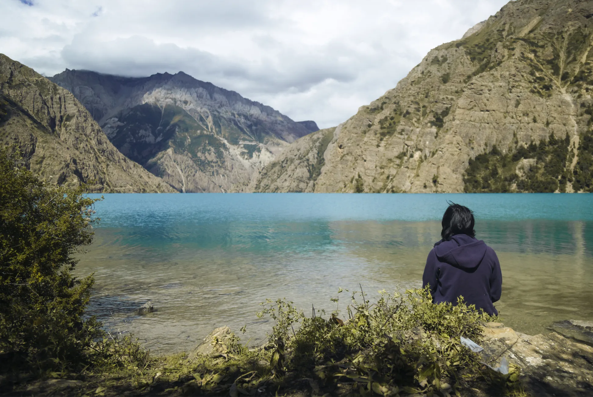
Above Suligad the trail works through forest and gorge to Chhekpa (2,720m), then climbs steeply towards Ringmo (3,640m), a Tibetan-style village on the slope above Phoksundo Lake. This is the first serious gain of sleeping altitude on the route and the point where most itineraries place their first acclimatization day, walking the lake shore or a nearby viewpoint and returning to the same camp.
Kang La & Shey Gompa: The High Crossing
Beyond the lake the trail enters the upper Phoksundo Khola and climbs towards Kang La (5,270m), the highest point on the standard circuit. The crossing is a long, cold push over scree and lingering snow, and on a clear morning the whole Dolpo range opens to the south. The descent lands at Shey Gompa (4,200m), a Tibetan Buddhist monastery and one of the most remote settlements in Nepal, where the day’s remaining walk is short and the evening is spent among the painted walls and prayer flags.
Saldang & the Upper Villages: The Long Traverse
From Shey the route crosses dry, open country to Namgung (4,430m) and then drops into Saldang (4,046m), one of the larger settlements in Upper Dolpo and a useful place to restock and take a cultural day. Side trips from Saldang reach Yangjer Gompa, a small monastery above the valley. The stages between here and Jeng La are the most remote walking on the route, with long stretches between settlements and little sign of other parties.
Jeng La & Dho Tarap: The Second Pass
Jeng La (5,090m) is the second major crossing and the high point of the middle section, climbed from a base camp reached the day before. Weather decides whether it goes through in a single push or over two days. The descent to Dho Tarap (3,944m) is long and steep, dropping into the head of the Tarap Khola gorge, and Dho Tarap is usually where the itinerary places a rest and laundry day before the faster stages home.
The Tarakot Descent: The Long Walk Out
The return leg is the least dramatic and the most tiring: a steady descent along the Tarap Khola through Toltol (3,523m) and Chhyugar (3,440m) to Tarakot (2,537m), then down to Dunai and back up the short spur to Juphal. Nothing here needs acclimatization, but the cumulative effect of three weeks of walking makes these final days long.
Key elevations
These rounded figures are orientation points, not a substitute for a mapped itinerary. Names and elevations vary between route variants and sources.
| Place or crossing | Approx. elevation |
|---|---|
| Juphal | 2,500m |
| Dunai | 2,000m |
| Ringmo / Phoksundo Lake | 3,600-3,670m |
| Kang La | about 5,270m |
| Shey Gompa | about 4,200m |
| Saldang | about 3,900m |
| Jeng La | about 5,060m |
| Dho Tarap | about 4,040m |
| Tarakot | about 2,450m |
The point of a gradual itinerary is to gain sleeping altitude in measured steps, with easier or rest days before the highest crossings. Do not rely on a high pass as an acclimatization day: it is a strenuous effort at altitude.
Itinerary
This 17-day walking itinerary starts on foot at Juphal and ends on foot there. Add separate days for flights and weather buffers; the remote high-pass stages may need adjustment for conditions, acclimatization and group pace. Confirm the exact camps and pass conditions with your operator before departure.
1Juphal to Suligad valley
Set out from Juphal and follow the trail down into the Suligad valley. The route leaves the airstrip and cultivated slopes behind, joining the river corridor that leads towards Phoksundo. Settle into camp and keep the first day measured as the crew gets the expedition underway.
2Suligad valley to Chhekpa
Continue up the valley beside the river, crossing forested slopes and small settlements on the way to Chhekpa. The trail undulates and can be affected by seasonal conditions; follow the guide’s pacing and camp where the day’s route plan allows.
3Chhekpa to Ringmo
Climb through the gorge and forest above Chhekpa, with the trail gaining height towards Phoksundo. Reach Ringmo above the lake and take the evening slowly; this is a substantial gain in sleeping altitude.
4Acclimatization at Ringmo and hike around Phoksundo Lake
Spend the day acclimatizing around Ringmo and Phoksundo Lake. Take a gentle hike along the shore or to a nearby viewpoint with your guide, allowing time to return to the same sleeping altitude. Keep the outing flexible, rest well and prepare for the remote trail beyond the lake.
5Ringmo to Kang La / Nangda La High Camp
Leave Ringmo and follow the trail beyond Phoksundo Lake into the upper valley. The landscape becomes more exposed as the route climbs towards the high camp below the pass. The precise camp and pass approach vary by itinerary, so use your operator’s route plan and keep a steady pace.
6Cross Kang La to Shey Gompa
Start early for the climb over Kang La, then descend towards Shey Gompa. This is a demanding high-altitude crossing; snow, wind and visibility can change quickly. Cross only when your guide judges conditions and the group’s health suitable, and take the descent carefully.
7Explore Shey Gompa and the Crystal Mountain area
Use a day to explore around Shey Gompa and the sacred landscape of Crystal Mountain. A local guide can explain the area’s religious significance and advise on a suitable walk. Ask before taking photographs and follow local practice around monasteries and sacred sites.
8Shey to Namgung
Leave the Shey area and cross dry, open terrain towards Namgung. Trails are remote and landmarks can be subtle, so stay with the guide and avoid walking ahead of the group.
9Namgung to Saldang
Descend towards Saldang, one of the larger settlements in Upper Dolpo. Check the next stages and resupply plan with the crew; services are limited and should not be assumed to be available.
10Explore Saldang and hike to Yangjer Gompa
Explore Saldang with a local guide, then hike to Yangjer Gompa if conditions and the group’s acclimatization allow. Keep the visit unhurried and respectful; ask before photographing people or entering religious spaces.
11Saldang to Jeng La Base Camp
Leave Saldang and climb towards Jeng La Base Camp, crossing sparsely settled high country. The approach is remote and exposed; keep warm, drink regularly and follow the guide’s pace ahead of the pass day.
12Cross Jeng La to Dho Tarap
Make an early start over Jeng La, then descend towards Dho Tarap. This is another strenuous pass day at altitude; the crossing depends on snow and weather, and the descent can be long. Keep the group together and follow your guide’s instructions.
13Explore Dho Tarap: rest and cultural day
Take a recovery day in Dho Tarap and explore the settlement with local guidance. Visit respectfully, rest and dry equipment, and let the crew prepare for the long descent along the Tarap Khola.
14Dho Tarap to Nawarpani
Descend from Dho Tarap along the Tarap Khola towards Nawarpani. The valley narrows as the trail drops; this is a long downhill stage, so take care on loose or uneven sections and keep a measured pace.
15Nawarpani towards Tarakot
Continue down the river valley towards Tarakot, following the route through small settlements and steep-sided terrain. The endpoint may shift with trail conditions and group pace; confirm the camp plan with your guide.
16Tarakot to Dunai
Follow the route from Tarakot back to Dunai, rejoining the lower approach corridor. Take time to rest and check onward flight arrangements with the operator, while keeping the final walk to Juphal in the plan.
17Dunai to Juphal
Complete the final walk back to Juphal. The trekking itinerary ends here; the flight out is not part of this day. Keep a separate weather buffer for the journey to Nepalgunj and Kathmandu.
Route Map
Elevation Profile
Logistics & Support
Getting There and Back
The usual approach is a flight from Kathmandu to Nepalgunj, followed by a small aircraft to Juphal, weather permitting. The walk begins at Juphal. Build in an overnight and weather buffer; some itineraries use road transport or adjust the staging around flight availability.
The walking route finishes back at Juphal. Fly to Nepalgunj and continue to Kathmandu when schedules and weather allow. Keep spare days before onward international travel.
Accommodation
Expect a camping expedition, not a continuous chain of teahouses. Simple lodges may be available in some villages, but camps are standard on remote stages and high passes. A support crew carries tents, kitchen equipment and provisions; discuss porter loads, crew welfare and waste management with the operator.
Guides & Porters
Nepal Tourism Board lists Upper Dolpo routes among those requiring a licensed guide and agency-issued TIMS. The restricted permit is processed through an agency, and the trek is organized as a supported group journey. Ask what the crew supplies, especially sleeping bag, sleeping mat, duffel and down jacket, and what you must bring or rent in Kathmandu.
Meals are prepared by the camp kitchen, with menus shaped by what can be carried and replenished along the route. Bring personal snacks, water treatment and any dietary essentials you cannot do without. Mobile service and internet are intermittent and should not be relied on across the circuit; ask whether the operator carries a satellite phone or messenger and how it is used in an emergency. Agree on crew tipping expectations before departure rather than treating one percentage as universal.
Permits
Upper Dolpo requires a restricted-area permit arranged through a registered trekking agency. The Department of Immigration currently lists the permit at USD 500 per person for the first 10 days, then USD 50 per person per additional day. The route also requires entry to Shey Phoksundo National Park; Nepal Tourism Board lists the foreign visitor fee at NPR 3,000. The agency should confirm whether the selected route enters Lower Dolpo permit zones, and account for any additional permit days and fees. Check the Department of Immigration permit schedule and Nepal Tourism Board park fees close to departure.
Ask for an itemized quote covering permits, guide and crew, flights, food, camping equipment, and contingency days. Clarify group-size conditions with the agency; permit implementation can vary and should be reconfirmed before payment.
Budget
As a broad planning signal, operator listings checked in 2026 show guided packages around USD 3,800-4,600 per person for itineraries near this length. That is not a fixed market tariff: group size, domestic flights, crew, camping equipment, route length and permit days change the total. One published operator quote is not a guarantee of value or availability. Ask for an itemized written quote that states whether Kathmandu–Nepalgunj and Nepalgunj–Juphal flights, meals, crew tips, insurance, personal gear and weather-delay nights are included.
There are few reliable places to withdraw cash across the circuit, so carry a reserve in Nepali rupees for drinks, charging, hot water and tips. Keep extra funds for delays and personal expenses.
Weather & Seasons
Dolpo’s rain shadow makes summer trekking possible, unlike many Nepal routes, but it does not remove weather or access risks. Snow on the passes, lower-valley rain and flight delays vary year to year.
| Month | What to plan for |
|---|---|
| May | Cold nights and lingering snow are possible on high passes; confirm the route is open before committing. |
| June | A useful early-season window, though conditions on high crossings can still vary and approach flights remain weather-dependent. |
| July-August | Inner Dolpo is relatively sheltered from monsoon rain, but lower approaches may be wet and flights can be disrupted. |
| September | Often a strong balance of pass access and clearer weather; nights grow colder as the month advances. |
| October | Crisp visibility is attractive, but cold increases and early snow can affect late-season crossings. |
The page’s listed months are a broad window, not a promise that every pass is open every week. Ask your agency for recent trail reports and keep buffer days around flights.
Safety and Responsible Travel
Altitude and remoteness deserve serious preparation. Headache, nausea, dizziness and unusual fatigue can signal altitude illness. Worsening symptoms mean no further ascent; severe breathlessness at rest, confusion or poor coordination require immediate descent and urgent medical help. A guide’s plan should identify who makes decisions, how the group communicates and what happens if an evacuation is needed. Helicopter rescue depends on weather, daylight, aircraft and landing conditions; insurance should explicitly cover trekking at the route’s elevations and evacuation. Ask a qualified clinician whether acetazolamide (Diamox) is appropriate for you, how to use it, and what contraindications apply; it is not a substitute for acclimatization or descent. See our altitude and difficulty guide and fitness training plan.
Dolpo’s villages and sacred places are living communities, not scenery. Ask before photographing people or entering religious sites, follow your guide’s advice, and pack out rubbish. The trip’s footprint includes the crew supporting it: choose an operator that explains staff pay, loads, equipment and waste handling clearly.
Tips
- Treat this as an expedition, not a holiday hike. Three weeks of self-supported camping in restricted country changes the planning rules: kit has to be carried, delays are measured in days, and comfort is a secondary concern.
- Build in pass-contingency days. Kang La and Jeng La are the two points most likely to turn a 17-day plan into a 21-day one. Agree in advance with your agency how the group makes the call on a crossing.
- Fly in the day before, fly out the day after. Juphal’s airstrip has a short usable window and a poor weather record. Overnight in Nepalgunj or Dunai both ways and treat the flights as the least reliable part of the trip.
- Confirm what the crew supplies. Sleeping bag, mat, duffel and down jacket are often provided but not always, and renting in Kathmandu is cheaper than buying. Get this in writing before you pay.
- Carry cash in small denominations. There is no reliable ATM across the circuit and change is scarce. Budget drinks, charging, hot water and tips in Nepali rupees.
- Ask before you photograph. Dolpo’s villages and monasteries are living communities with long-standing Tibetan traditions. A local guide will tell you what is welcome and what is not.
- Get the altitude plan in advance. Two passes above 5,000m in three weeks deserves a considered acclimatization schedule. Talk to a clinician about Diamox before you travel, not on the trail.
- Ask the operator about crew conditions. Porters and cooks on restricted routes carry heavy loads over long stages. How they are paid, equipped and treated is a fair question to ask, and a good filter for the operator.
- Do not buy snow gear on guesswork. Whether you need microspikes or snow goggles depends on current pass conditions. Ask the guide what the route requires and rent rather than buy if it is uncertain.
Related Treks
For another long, remote circuit with established village lodges, see the Manaslu Circuit. For a shorter cultural journey through a high, dry landscape, compare Upper Mustang. Nepal Tourism Board also lists Lower Dolpo, Upper Dolpo–Jomsom and Kagmara Pass routes; these are distinct itineraries, not interchangeable shortcuts around the full circuit. Prepare with our permits and logistics guide, gear guide and fitness training plan.
Frequently Asked Questions
Planning
How long does the Upper Dolpo trek take?
The itinerary below allows 17 walking days for the full circuit. Add separate time for flights and weather buffers; confirm with your agency whether pass conditions or your group's pace call for extra walking or acclimatization days.
When is the best time to go?
Late spring to early autumn is the practical window for the high route, with the exact timing shaped by snow on the passes and flight conditions. The rain-shadowed valleys can be drier during the monsoon than much of Nepal, but rain can still disrupt flights and roads. Confirm conditions locally before booking.
How do I reach the trailhead?
The usual approach is to fly from Kathmandu to Nepalgunj, then take a small aircraft to Juphal, weather permitting. Some itineraries require an overnight in Nepalgunj or Dunai. Build buffer days around the flights; schedules can shift with weather.
Difficulty & Altitude
How difficult is Upper Dolpo?
This is an extreme, expedition-style trek: long days in remote country, several passes above 5,000m, limited resupply and substantial time away from road access. Previous high-altitude, multi-day trekking experience and strong fitness are essential.
Is the trek technical?
It is not a climbing route, but high passes can involve snow, ice, loose scree and difficult route-finding. Conditions change by season. Your guide may alter or postpone a crossing; do not treat a published itinerary as a guarantee that every pass will be open.
Is there a risk of altitude sickness?
Yes. The route spends extended time at altitude and crosses high passes. Plan gradual acclimatization, monitor symptoms, and descend if they worsen. Discuss a personal altitude plan with a qualified clinician before travel.
How fit do I need to be?
Arrive ready for repeated long walking days on rough terrain, often with significant climbing and a daypack. Build up with regular hill walks and back-to-back hikes over several months; prior multi-day trekking above 4,000m is strongly useful, though no amount of training removes altitude risk.
Permits & Costs
What permits are required?
Upper Dolpo requires a restricted-area permit arranged through a registered trekking agency, plus Shey Phoksundo National Park entry. The Department of Immigration lists USD 500 per person for the first 10 days and USD 50 per person per additional day. The exact route may also cross Lower Dolpo permit areas; have your agency confirm every permit and covered day before paying.
Do I need a guide and TIMS?
Yes. Nepal Tourism Board lists Upper Dolpo and Upper Dolpo–Jomsom among routes requiring a licensed guide and agency-issued TIMS. Restricted-area paperwork is handled through a registered agency. Confirm current group and permit conditions with the agency before booking.
How much should I budget?
Recent operator listings put a guided full-circuit package roughly in the USD 3,800-4,600 range, but trip length and inclusions vary widely. Add personal expenses, tips, insurance and any international flights; request an itemized quote and confirm the restricted-area permit calculation for your exact dates.
Route & Accommodation
Is this a teahouse trek?
Not for most full-circuit itineraries. Expect organized camping, a guide and support crew, food carried between settlements, and basic facilities. Some villages have simple lodges or homestays, but do not plan the route around finding a room each night.
What are the main highlights?
The route is known for the deep-blue waters of Phoksundo Lake, the settlements of Ringmo, Dho Tarap and Saldang, the remote Shey Gompa area, and broad views across high, dry valleys. The exact highlights depend on which circuit your agency proposes.
Can I trek Upper Dolpo independently?
No. The region is restricted and the route requires agency-arranged permits and a licensed guide. The remoteness, camping logistics and changing pass conditions also make independent travel impractical.
Altitude & Safety
Can I evacuate by helicopter?
A helicopter evacuation may be possible if weather, landing conditions and aircraft availability allow, but it is not guaranteed. Confirm that your insurer covers high-altitude helicopter rescue and that the operator has a working emergency communications plan.
What if a pass is closed by snow?
Pass crossings on this route depend on conditions that can change within a day. Guides routinely adjust or postpone a crossing, which may mean an extra camp, a different pass or a rest day. Build buffer days into the schedule and agree in advance on how the group makes those decisions.